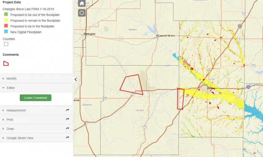
Lyon County is in the process of updating its flood maps.
Zoning and Floodplain Administrator Sam Seeley says the county is working on what’s called a flood risk map. He says the end result will give county officials a better sense of what properties may actually be in trouble during a flood.
The Federal Emergency Management Agency has mandated the work and is funding it. The Kansas Department of Agriculture and Department of Water Resources are working with Wood Environment and Infrastructure on the mapping. Seeley says the new maps will also pinpoint where communities should focus and flood mitigation efforts.
Lyon County went from a longstanding set of paper maps to digital maps in 2008.
The current review period continues until Feb. 22, with an open house in May. Maps will then be official by November.
Click here for a link to Lyon County’s flood map data through the Kansas Department of Agriculture, including ways to leave comments. The link demonstrates the Neosho River map but also has additional links to the Cottonwood and Marais des Cygnes rivers.


