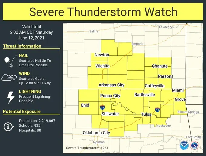
The threat of severe weather is pushing south as Friday evening progresses.
A severe thunderstorm watch is now in effect until 2 am Saturday for Chase and Greenwood counties. Isolated instances of 80-mph wind gusts and 2-inch hail are possible.
A separate watch involving Lyon, Coffey and Osage counties — and that had originally included Chase and Greenwood counties — expired at 7 pm.
Stay with KVOE, KVOE.com and KVOE social media for updates.
5 pm Friday: Isolated severe weather reported in Osage County
Strong storms northeast of Emporia have generated isolated severe weather.
*Quenemo: Maximum wind gust 61 mph. Damage reports pending.
A severe thunderstorm watch covers Lyon, Chase, Coffey, Greenwood and Morris counties until 7 pm. Stay with KVOE, KVOE.com and KVOE social media for updates.
12:30 pm Friday: Area placed under severe thunderstorm watch
Lyon County and surrounding counties are now in a severe thunderstorm watch in anticipation of strong storms later Friday.
The National Weather Service has issued a watch until 7 pm. Winds as high as 85 mph, hail to the size of tennis balls, heavy rain, frequent lightning and brief, isolated tornadoes are possible.
Stay with KVOE, KVOE.com and KVOE social media for updates. Join KVOE’s social media on Facebook@kvoenews and Twitter@kvoeam1400 for instant alerts, and download the free KVOE mobile app so you have our severe weather coverage wherever you may be.
11:45 am Friday: 70-mph winds, 2-inch hail possible with severe storm potential Friday afternoon and evening
Strong to severe thunderstorms now appear likely for much of the KVOE listening area Friday afternoon and evening.
Storms should soon move south out of Nebraska into an unstable atmosphere across eastern and east-central Kansas, and TV-13 meteorologist Doug Meyers says mid-afternoon to mid-evening it the time to watch for severe weather, including high winds, large hail, an isolated tornado and very heavy rainfall.
One to two inches of rainfall is also possible, although many locations may well get less than an inch of rain with these storms.
The Storm Prediction Center has an enhanced risk of severe weather east of a Council Grove to Teterville line, with a slight risk further west.
We’ll keep you updated on KVOE, KVOE.com and KVOE social media. Be sure to join KVOE’s Facebook and Twitter accounts for instant alerts if you haven’t already done so, and download the free KVOE mobile app to take our severe weather coverage wherever you may be.
8:45 am Friday: Potential for high winds prompts upgrade to enhanced severe weather risk
High wind potential is driving an enhanced severe weather risk now in place for most of the KVOE listening area for Friday afternoon and early evening.
Winds could be above 70 mph starting by late afternoon at the latest, with quarter-sized hail and heavy rainfall also possible east of a Council Grove to Teterville line. Brief, weak tornadoes can’t be ruled out but are unlikely.
The National Weather Service is tracking storms moving through Nebraska. Current indications are a bow echo could move north-to-south across the area, increasing the risk of high winds ahead of the storm complex.
We’ll keep you updated on KVOE, KVOE.com and KVOE social media. Be sure to join KVOE’s Facebook and Twitter accounts for instant alerts if you haven’t already done so, and download the free KVOE mobile app to take our severe weather coverage wherever you may be.
6 am Friday: Hail, high winds main concerns with slight severe weather risk areawide Friday
Thunderstorms are likely Friday afternoon, and some could be strong to severe.
A slight risk of severe weather covers the KVOE listening area, with winds up to 60 mph and hail to the size of quarters possible. Heavy rainfall is also possible, which could lead to isolated flooding. Storms are expected by mid-afternoon.
Before the storms arrive, we are looking at a sweltering day with highs in the low 90s and heat index readings as high as 103.
We’ll keep you updated on KVOE, KVOE.com and KVOE social media.


