Coming later this month: a slight adjustment in severe weather warnings.
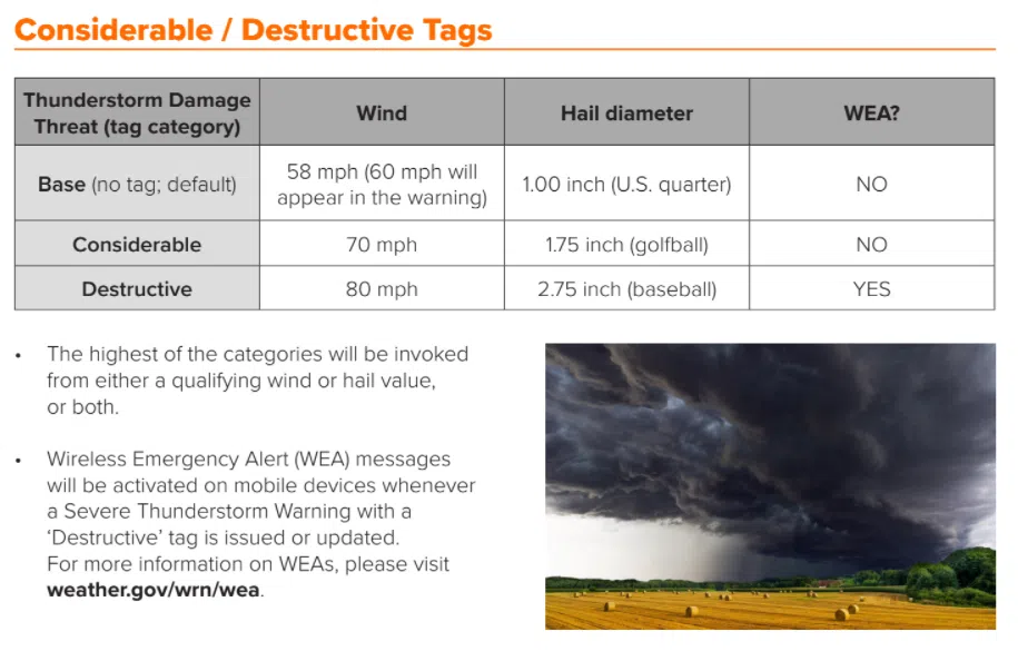
The baseline criteria for severe thunderstorms — 58-mph winds and quarter-sized hail — will not change. However, the National Weather Service will put greater emphasis on high-end severe storms through the use of Wireless Emergency Alerts. Warning Coordination Meteorologist Chad Omitt says this is part of the Weather Service’s push to better underscore storm risks as a whole.
Storms with the potential of wind gusts of at least 80 mph and baseball-sized hail or larger will get the emergency text alerts, a step typically reserved for tornado warnings. The Weather Service will also use special threat tags in its statements to indicate potential damage, with “considerable” being used for winds between 70-80 mph or hail to the size of golf balls and “destructive” for the 80 mph winds and baseball-sized hail.
Separately, the Weather Service is moving away from “significant weather alert” language in its text alerts, also reconfiguring its warning information on hazards, alert sources and impacts into a bullet-point format.
The new changes begin July 28.


