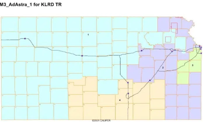
Federal court will likely have to resolve a budding dispute over the state’s Congressional redistricting map.
Areawide, the proposed map moves Lyon, Chase, Morris and Wabaunsee counties of the so-called Big First District and into the Second along with Coffey and Osage Counties.
The Kansas House passed changes to the map by a 79-37 margin Wednesday, with Mark Schreiber of the 60th District and Eric Smith of the 76th District, both Republicans, voting for the bill. Schreiber has been unavailable for comment, but Smith says he’s pleased with the map for two reasons: it doesn’t split Coffey County and it meets federal population guidelines.
Audio PlayerFellow Republican Ron Highland of the 51st District voted present. The reason he didn’t vote in favor? Opposition from Lyon and Wabaunsee counties — and an earful much closer to home.
Audio Player
Audio PlayerThe House vote followed approval by the Kansas Senate on a 26-9 margin. 17th District Senator Jeff Longbine of Emporia voted absent, but he says the changes could be good for his district.
Audio PlayerGreenwood County stays in the Fourth District.
The main concerns from Democrats and certain voting rights groups center on moving part of Wyandotte County from the Third District alongside Johnson County into the Second District as well as the move of the Lawrence area from the Second District into the First. Both moves involve moving Democratic strongholds into more Republican territory, but all three Republican lawmakers surveyed by KVOE News say the map reflected evening out population numbers more than anything else.
A veto from Governor Kelly would mean a two-thirds vote in both the House and Senate to override. At this time, both the House and Senate fall short — meaning federal court action on the map is likely. Discussions on state redistricting maps could begin next week.


