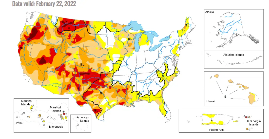
Last week’s moderate to heavy snowfall caused no noticeable change to the most recent US Drought Monitor map.
Abnormally dry conditions still hold south and west of a line from Council Grove to Reading to Lebo. Areas north and east of that line are not in any drought status.
Thursday’s update followed the Feb. 17 snowfall that dropped anywhere from 2-9 inches of snow areawide, including 5-9 inches across most of Lyon County. The snowfall came on the day of the Drought Monitor’s previous map.
Statewide, over 90 percent of Kansas is under some sort of drought designation, with pockets of severe drought in north-central, central and northwest Kansas. Extreme drought is currently limited to far southwest Kansas.
Nationally, drought is prevalent across the western half of the country and across the Gulf Coast.
Drought information is calculated after 6 am Tuesday and released Thursday.


