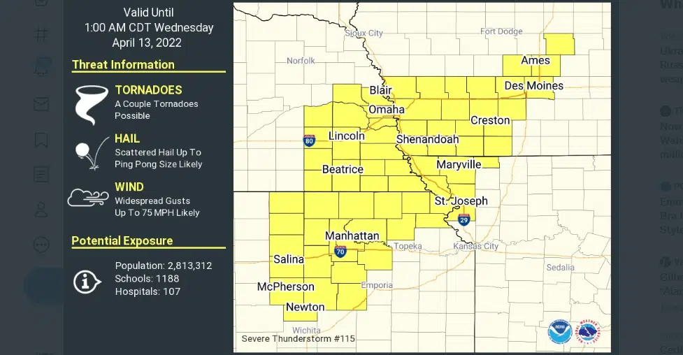
Parts of the KVOE listening area are in a severe thunderstorm watch until early Wednesday.
Chase, Morris and Wabaunsee counties are involved until 1 am. The main concerns are wind gusts as high as 75 mph and hail to the size of ping pong balls, or 1.5 inches in diameter, Isolated tornadoes can’t be ruled out.
Strong storms are expected to cross the area late Tuesday night into the pre-dawn hours Wednesday. Following the storm activity, Wednesday will be more stable but will also be sharply cooler with high temperatures approaching 60 degrees.
Be sure to stay tuned to KVOE, KVOE.com and KVOE social media for updates. If you haven’t already done so, join KVOE’s social media channels on Facebook, Instagram and Twitter to get the latest developments. KVOE’s Storm Team volunteer spotter network is also poised to give “ground truth” information if needed.
Noon Tuesday: Winds up to 65 mph, egg-sized hail are main concerns if severe weather develops Tuesday evening
Strong to severe weather looks to be a concern areawide Tuesday evening.
Storms could move across the area between sunset and midnight. Winds as high as 65 mph are now the most likely threat, along with hail to the size of eggs. The risk for tornadoes and flooding is currently low.
Storms will likely develop west of Emporia and will move as fast as 50 mph across the area.
6 am Tuesday: Large hail, damaging winds lead concerns with enhanced severe weather risk areawide Tuesday night
Strong and severe thunderstorm activity is possible across the KVOE listening area Tuesday evening into early Wednesday.
Overall, the KVOE listening area is still in an enhanced risk for severe weather, with hail to the size of eggs as the lead risk along with damaging winds. Tornadoes are possible, although the risk is quite a bit lower than it was in Monday’s forecast.
TV-13 meteorologist Doug Meyers says sunset to midnight appears to be the main window for storms across the area.
Wind advisories start at noon across the area with afternoon wind gusts between 40-50 mph.
Meyers and Lyon County Emergency Management Director Jarrod Fell are encouraging you to review your severe weather plans. Fell says there should be at least two components to any severe weather plan, including exactly how you will get severe weather information and where you plan to take shelter, notably the lowest floor of your home or building and away from windows.
If you are out and about across Lyon County when severe weather strikes, be advised there are no specifically-designated public shelters. Also, Fell says you should not call Lyon County’s Emergency Dispatch Department if you want information about severe weather or if you need last-minute help developing your safety plan.


