Thursday has seen record high temperatures, however, the local heatwave may be coming to an end soon.
A daily record high was reset Thursday when temperatures rose to 93 degrees surpassing the previous mark of 90 degrees set back in 1962.
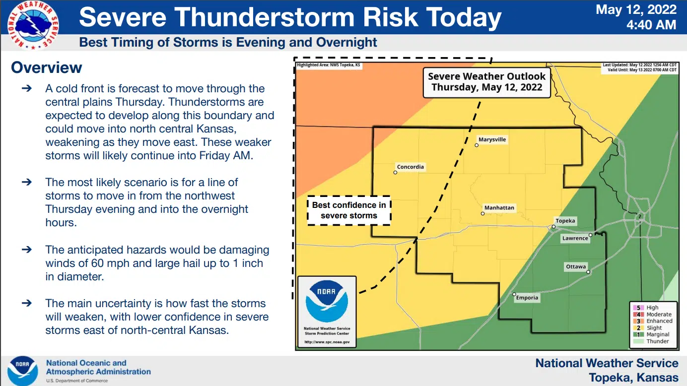
Showers and storms remain a possibility late Thursday night into early Friday morning, but storms may well be weakening as they approach meaning the risk of severe weather will be relatively low. Areas west of the Kansas Turnpike are in a slight risk for severe weather, with areas east of the Turnpike in a marginal risk. Wind and hail are the main concerns.
Another round of potentially strong to severe storms is possible Friday afternoon through the evening hours, but the risk is low. All area counties are in a marginal risk area for the prospect of hail and wind.
Saturday night into early Sunday offers a slight risk of severe weather areawide, again for hail and wind.
High temperatures will be in the 80s beginning Friday and continuing through at least Tuesday.
Stay with KVOE, KVOE.com and KVOE social media for updates. Join KVOE’s social media channels on Facebook, Instagram and Twitter if you haven’t already done so. KVOE’s Storm Team volunteer spotter network will provide reports if needed.
8:35 am Thursday:
The current heat spell is about to be broken.
A daily record high might be reset Thursday. The record of 90 degrees dates back to 1962, and the current forecast calls for a 91-degree day.
Showers and storms are possible late Thursday night into early Friday morning, but storms may well be weakening as they approach. Areas west of the Kansas Turnpike are in a slight risk for severe weather, with areas east of the Turnpike in a marginal risk. Wind and hail are the main concerns.
Another round of potentially strong to severe storms is possible Friday afternoon through the evening hours, but the risk is low. All aea counties are in a marginal risk area for the prospect of hail and wind.
Saturday night into early Sunday offers a slight risk of severe weather areawide, again for hail and wind.
High temperatures will be in the 80s beginning Friday and continuing through at least Tuesday.
Stay with KVOE, KVOE.com and KVOE social media for updates. Join KVOE’s social media channels on Facebook, Instagram and Twitter if you haven’t already done so. KVOE’s Storm Team volunteer spotter network will provide reports if needed.


