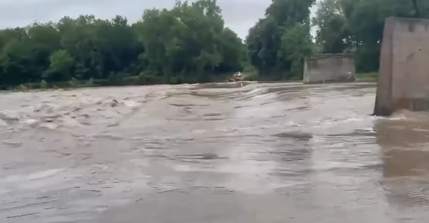
Flooding has officially ended for Lyon County.
The National Weather Service has canceled flood warnings for the Cottonwood River at Emporia and the Neosho River at Neosho Rapids. The Neosho went back within its banks shortly before 9 am, while the Cottonwood went below flood stage early Friday afternoon.
10 am Friday: Flood warning canceled for Neosho River at Neosho Rapids
Flooding has officially ended for the Neosho River at Neosho Rapids, and it’s close to ending for the Cottonwood River at Emporia.
The National Weather Service canceled its flood warning for the Neosho River shortly before 9 am Friday after the river went below the 22-foot flood stage. The river crested Thursday at 23.26 feet.
The flood warning continues for the Cottonwood at Emporia until Saturday morning, but it could also end early. The river was at 20.64 feet Friday morning, above flood stage of 20 feet. It should go below flood stage Friday afternoon after cresting just over 22 feet Thursday.
Several road closures were added in Lyon County late Thursday, but County Engineer Chip Woods says most county roads are in decent to good shape heading into the weekend.
The current list of Lyon County closings:
*Road A (Lyon-Chase county line) north of US Highway 50; at Lyon County Road 180
*Road 123 at W
*Road 130 at T
*Road 137 at S; at T
*Road 140 west of Kansas Highway 99; at J
*Road 145 at V-7
*Road 150 east of Kansas Highway 99; west of Kansas Highway 99; at D; at: at P; at R
*Road 155 at F-5; at G
*Road 160 at G; at H; at J
*Road 170 at G
*West South at Road H
Unbound Gravel has made some adjustments for riders in the 200-mile and XL races, sending riders east out of Eureka instead of south, where certain parts of the original course are still impassable after anywhere from 3-6 inches of rain earlier this week.
Rain chances return early Saturday and continue through Thursday. There is also a marginal risk of severe weather both weekend days, with wind, hail, up to an inch of additional rainfall and lightning all possible.
Stay with KVOE, KVOE.com and KVOE social media with flooding continuing at this time and the risk of more flooding into next week.
7:30 am Friday: Flooding eases across central Lyon County, but road closure list expands with more rainfall expected this weekend
Flooding continues from Emporia to Neosho Rapids, but the floodwaters are easing at this time.
A flood warning continues for the Cottonwood River at Emporia until Saturday morning. The river was at 20.98 feet early Friday, above the 20-foot flood stage but below the crest Thursday of 22.01 feet. It should go below flood stage Friday afternoon.
A flood warning continues for the Neosho River at Neosho Rapids until Friday evening. The river is at 22.03 feet, just above flood stage of 22 feet and below Thursday’s crest of 23.26 feet. It should go below flood stage by Friday afternoon.
Minor flooding is ongoing at both river gauges.
Lyon County’s list of road closures had been trimmed early Thursday afternoon but has now lengthened as floodwaters have moved further downstream towards the Lyon-Coffey county line:
*Road A (Lyon-Chase county line) north of US Highway 50; at Lyon County Road 180
*Road 123 at W
*Road 130 at T
*Road 137 at S; at T
*Road 140 west of Kansas Highway 99; at J
*Road 145 at V-7
*Road 150 east of Kansas Highway 99; west of Kansas Highway 99; at D; at: at P; at R
*Road 155 at F-5; at G
*Road 160 at G; at H; at J
*Road 170 at G
*West South at Road H
Roads have reopened west of Americus and between Emporia and Americus.
Friday should be another dry day, but rain chances return early Saturday and continue — at least at low levels — through Thursday. The highest chances for rainfall are Saturday into early Sunday. There is also a marginal risk of severe weather both weekend days, with wind, hail, brief heavy rain and lightning all possible.
Stay with KVOE, KVOE.com and KVOE social media with flooding continuing at this time and the risk of more flooding into next week.


