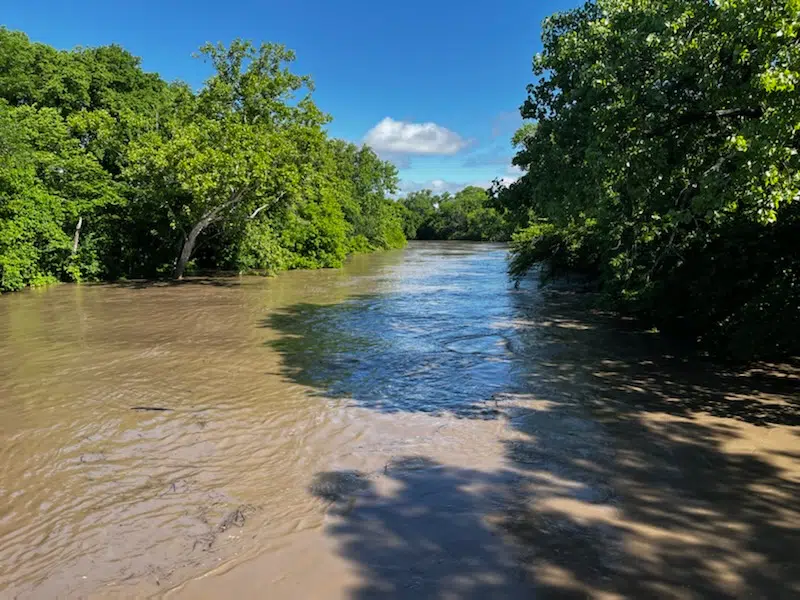
With more rainfall forecasted through the next several days, the National Weather Service is anticipating more potential rounds of flooding across portions of the KVOE listening area.
A flood watch has been issued for Chase and Greenwood counties from 7 pm Tuesday until 7 am Wednesday. There is a slight severe weather risk in place across the area Tuesday night into Wednesday morning and again Thursday.
Storms could bring hail, high winds and “excessive rainfall.” The watch comes as two area river gauges remain in flood warnings.
A warning for the Cottonwood at Emporia now goes until Thursday morning. The river is at 23.81 feet, slightly below a potential crest of 23.89 feet but above the current projected crest of 23.7. It could go below flood stage Wednesday afternoon.
A warning for the Neosho at Neosho Rapids goes until Wednesday afternoon. The river is at 22.85 feet, above flood stage of 22. It could crest at 23 feet Tuesday afternoon and go below flood stage early Wednesday.
The list of Lyon County roads currently closed includes:
*Road A (Lyon-Chase county line) north of US Highway 50; at Lyon County Road 180
*Road E north of Road 140
*Road 123 at W
*Road 130 at T
*Road 137 at S; at T
*Road 140 west of Kansas Highway 99; at J
*Road 145 at V-7
*Road 147 east of Road H
*Road 150 east of Kansas Highway 99; west of Kansas Highway 99; at D; at J; at P; at R
*Road 155 at F-5; at G
*Road 160 at G; at G-5; at H; at J
*Road 170 at G
*West Sixth at Road G, at Road 160
*West South at Road H
*1600 block Road H-5
County Engineer Chip Woods has reported several instances of people ignoring the barricades on county roadways, either moving them, running them over or stealing them.
We’ll keep you updated on KVOE, KVOE.com and KVOE social media.
10:40 am: WEATHER: Flood warning dropped for Cottonwood River at Cottonwood Falls; Lyon County Floodplain Office to get busy after flooding ends
Just two river gauges are in flood across the KVOE listening area Tuesday. Both are in Lyon County.
Minor flooding continues at the Cottonwood River’s gauge at Soden’s Grove in south Emporia as well as the Neosho River gauge at Neosho Rapids. Both gauges remain in flood warnings at this time:
The warning for the Cottonwood at Emporia now goes until Thursday morning. The river is at 23.86 feet, slightly below a potential crest of 23.89 feet but above the current projected crest of 23.7. It could go below flood stage Wednesday afternoon.
The warning for the Neosho at Neosho Rapids goes until Wednesday afternoon. The river is at 22.71 feet, above flood stage of 22. It could crest at 22.9 feet Tuesday afternoon and go below flood stage early Wednesday.
Previous warnings for the Cottonwood River at Plymouth and Cottonwood Falls have been canceled. Both went above flood stage earlier this week but have receded.
One might think the Lyon County Zoning and Floodplain Management Office would be busy in the midst of ongoing flooding, but Administrator Sam Seeley — a guest on KVOE’s Morning Show on Tuesday — says he actually gets busy after floodwaters subside. During floods, he looks at the worst areas and whether structures are being impacted. His work begins as residents start cleaning up.
Seeley again encouraged residents to use the Flood Observation Reporting Tool, or FORT, that’s available online at www.ks.gov by searching for “Recurring Flood ID Project.” Residents will need to select the “Add Flood Location,” select the severity level and then draw a square or polygon that best shows the flooding area. Residents will also be asked to list the type of flood, if water rescues were needed, how often the area floods and other kinds of information.
The FORT tool could lead to area-specific awareness efforts. Seeley says this could make it easier for county officials to determine where to raise roads, add drainage or add other flood mitigation efforts.
Residents can call the Zoning and Floodplain Office at 620-341-3471 with questions.
The list of Lyon County roads currently closed includes:
*Road A (Lyon-Chase county line) north of US Highway 50; at Lyon County Road 180
*Road E north of Road 140
*Road 123 at W
*Road 130 at T
*Road 137 at S; at T
*Road 140 west of Kansas Highway 99; at J
*Road 145 at V-7
*Road 147 east of Road H
*Road 150 east of Kansas Highway 99; west of Kansas Highway 99; at D; at J; at P; at R
*Road 155 at F-5; at G
*Road 160 at G; at G-5; at H; at J
*Road 170 at G
*West Sixth at Road G, at Road 160
*West South at Road H
*1600 block Road H-5
Showers and storms are expected Tuesday night into Wednesday morning, with more rainfall possible Thursday into Friday morning. There is currently a slight risk of severe weather Tuesday night and again Thursday night. All hazards are possible Tuesday night, but the main concerns by far will be hail and wind. Hail looks to be the main issue Thursday night.
We’ll keep you updated on KVOE, KVOE.com and KVOE social media.
6:30 am Tuesday: Flood warnings continue at Emporia, Cottonwood Falls, Neosho Rapids
One flood warning has been canceled west of Emporia, but flood warnings continue for the Cottonwood River at Emporia and Cottonwood Falls as well as the Neosho River at Neosho Rapids.
Minor flooding is underway at all three gauges.
The warning for the Cottonwood at Emporia now goes until Thursday morning. The river is at 23.87 feet, above the current projected crest of 23.7. It could go below flood stage Wednesday afternoon.
The warning for the Cottonwood at Cottonwood Falls is in place until Tuesday evening. The latest data had the river at 9.3 feet, below crest of 9.5 feet but above flood stage of 9 feet. It should go below flood stage Tuesday.
The warning for the Neosho at Neosho Rapids goes until Wednesday afternoon. The river is at 22.55 feet, above flood stage of 22. It could crest at 23 feet Tuesday and go below flood stage early Wednesday.
The warnings continue as the KVOE studios got 0.20 inches of rainfall early Tuesday, while the Emporia Municipal Airport got 0.27 inches. They also continue as two people got stuck on a water-covered road just south of Emporia on Monday. The van got stuck near Roads 150 and J around 2:45 pm. Emporia Fire Battalion Chief Jesse Taylor says the driver got the van into water, tried unsuccessfully to turn around and called 911. Both people walked to safety afterward.
The list of Lyon County roads currently closed includes:
*Road A (Lyon-Chase county line) north of US Highway 50; at Lyon County Road 180
*Road E north of Road 140
*Road 123 at W
*Road 130 at T
*Road 137 at S; at T
*Road 140 west of Kansas Highway 99; at J
*Road 145 at V-7
*Road 147 east of Road H
*Road 150 east of Kansas Highway 99; west of Kansas Highway 99; at D; at J; at P; at R
*Road 155 at F-5; at G
*Road 160 at G; at G-5; at H; at J
*Road 170 at G
*West Sixth at Road G, at Road 160
*West South at Road H
*1600 block Road H-5
Showers and storms are expected Tuesday night into Wednesday morning, with more rainfall possible Thursday into Friday morning. There is currently a slight risk of severe weather Tuesday night and again Thursday night. All hazards are possible Tuesday night, but the main concerns by far will be hail and wind. Hail looks to be the main issue Thursday night.
We’ll keep you updated on KVOE, KVOE.com and KVOE social media.


