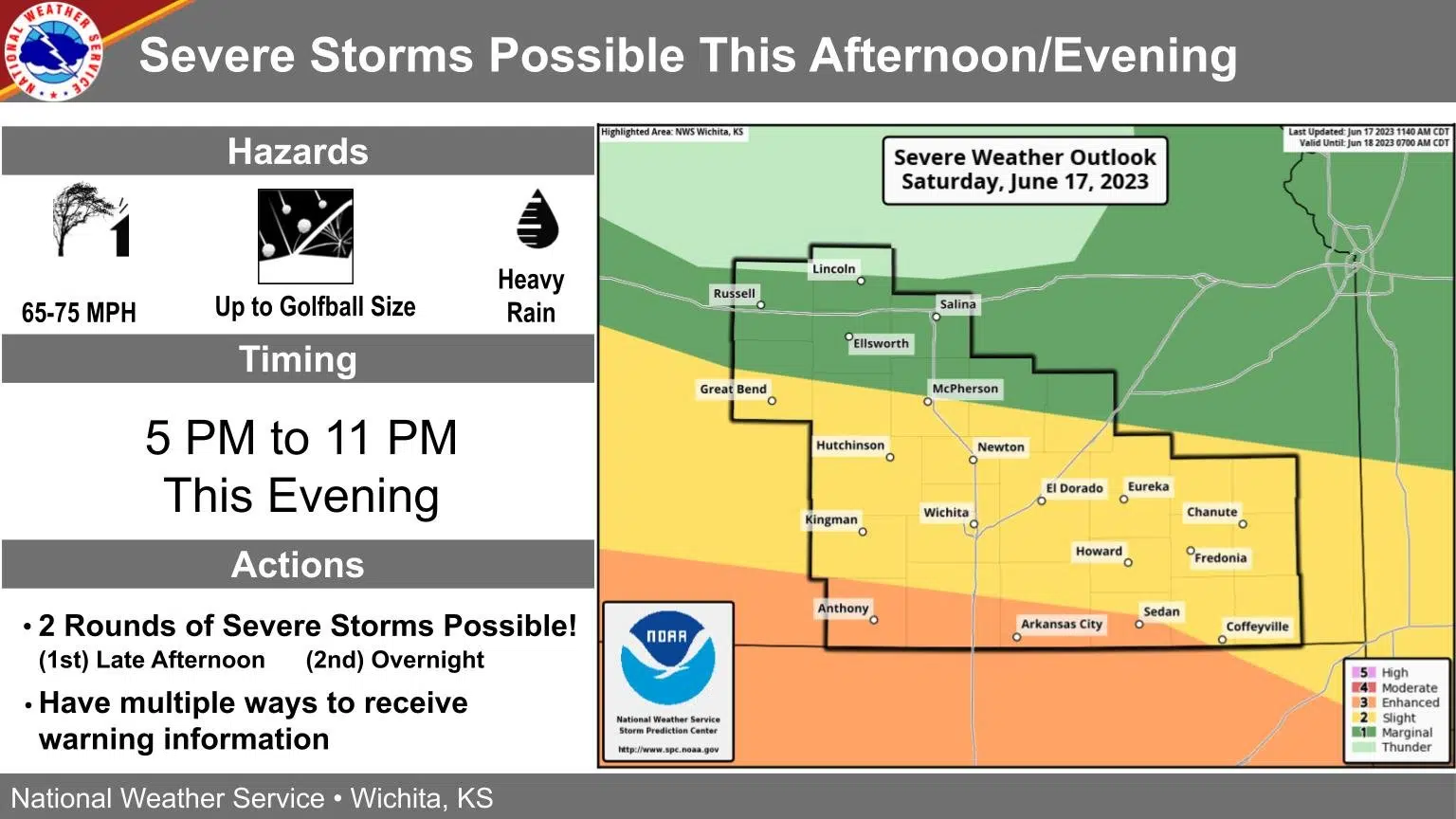
Severe weather remains possible for late Saturday through early Sunday.
The dividing line between a marginal and slight risk has fluctuated in the Storm Prediction Center’s Saturday outlooks and now sits from near Cottonwood Falls to Olpe to Burlington, slightly north of the mid-morning update, with areas south of that line in the slight risk area. Regardless of the risk level, the main concerns are hail, wind and heavy rain.
The National Weather Service is still predicting two possible periods for storms, one for late afternoon into mid-evening and one for the overnight hours early Sunday.
8:30 am Saturday: Marginal severe weather risk now virtually areawide, but storms may still cover Saturday’s outdoor events
As morning storms weakened while approaching Emporia early Saturday, the severe weather risk appears to be pushing further south through early Sunday.
In its update just after midnight, the Storm Prediction Center had a marginal-to-severe risk areawide, with areas south of a line from near Dunlap to just north of Emporia to Lebo in the slight risk area. For its 8 am update, the SPC put virtually the entire KVOE listening area in a marginal risk, with areas south of a Cassoday to Hamilton line in the slight risk area.
Storms with heavy rain began weakening just west of the KVOE listening area around sunrise Saturday. Other activity is still expected by mid- to late afternoon through the early overnight hours, with hail, wind and heavy rainfall all possible. This would still overlap play at the Dynamic Discs Open and the related block party, as well as the city’s Juneteenth Celebration. Adjustment plans have not been announced.
Stay with KVOE, KVOE.com and KVOE social media for updates.
7 am Saturday: Numerous storm chances Saturday, but severe weather risk may hold off until late afternoon through overnight
Area counties are almost evenly split between a marginal and slight severe weather risk for Saturday.
So far, the line between the two risk areas has set up from near Dunlap to just north of Emporia to Lebo, with areas south of that line in the slight risk area. The National Weather Service expects two waves of activity possible, one between mid-afternoon and evening and the other from evening to the early overnight hours. The afternoon round could bring large hail, damaging wind and locally heavy rain, while the late round could see wind and hail.
Storms are possible earlier in the day, but those are not expected to be severe.
The short-term forecast overlaps several outdoor events in Emporia, including play at the Dynamic Discs Open and the block party, as well as the city’s Juneteenth Celebration.
High temperatures Saturday should be right at 90 degrees. With a moderate chance of non-severe storms Sunday morning, Father’s Day should top out in the mid-80s.
Stay with KVOE, KVOE.com and KVOE social media for updates.


