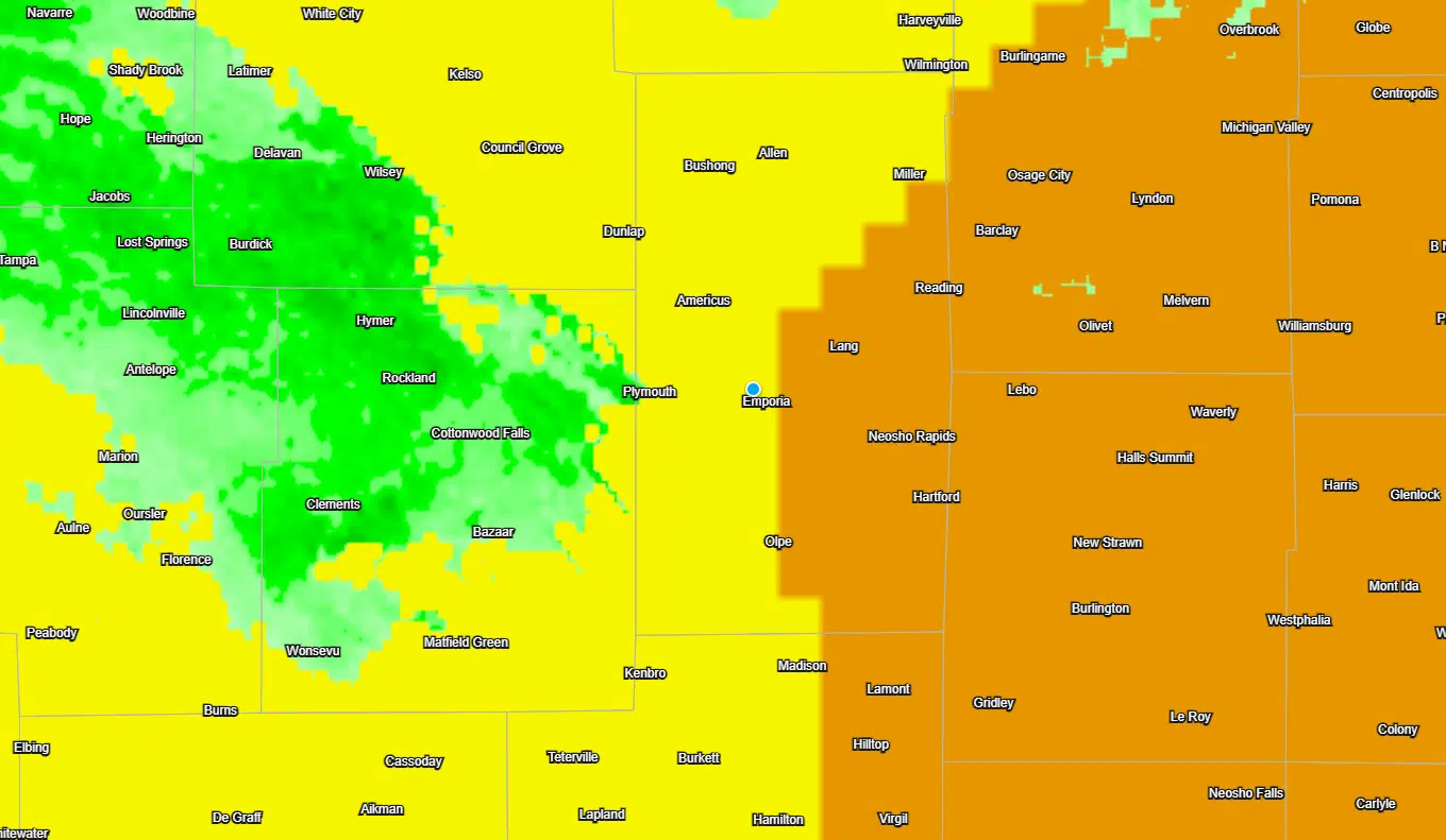
A risk of severe weather continues through the evening hours Wednesday.
Initially, there were concerns that an outflow boundary from storms in Nebraska and Iowa would push through the KVOE listening area by late afternoon, bringing severe weather chances with it. The outflow boundary had cleared the area before noon, but a cold front is still sagging towards the area — and there is enough time between the arrival of the outflow boundary and the expected arrival of the cold front to keep severe weather chances in the short-term forecast.
Currently, there is an enhanced risk area along and east of a line from Burlingame to Emporia to Madison, with a slight risk west of that line. All severe weather hazards are possible, with 70-80 mph winds and hail to 2 inches in diameter as the main threats.
Storms are expected to develop between 4-7 pm and track to the south-southeast before leaving the area.
Be sure to stay with KVOE, KVOE.com and KVOE social media for updates. If you haven’t joined KVOE’s social media channels for news, weather, sports and community information, look for Facebook@kvoenews, Instagram@kvoenews, YouTube@kvoenews and Twitter@kvoeam1400.
6:50 am Wednesday: Strong to severe storms possible after extremely hot Wednesday
An uncomfortable day is ahead across the KVOE listening area.
Triple-digit heat returns areawide as high temperatures get to 100 degrees and heat index readings climb as high as 110. This means heat advisories for all area counties beginning at noon.
TV-13 meteorologist Doug Meyers says the only difference between this heat event and the one from June 28-30 is this will be a shorter heat burst.
Storms triggering severe thunderstorm and tornado warnings in Nebraska early Wednesday will produce an outflow boundary that will bring a risk of severe weather to the entire area by late afternoon. All hazards are possible, but the main concerns are wind gusts at or above 75 mph and hail at least as big as tennis balls.
Storms are possible but unlikely Thursday, with a better chance of storms — and another slight severe weather risk — for all area counties Friday. Hail and wind are the main concerns for the Friday activity.
Stay with KVOE, KVOE.com and KVOE social media for updates.


