


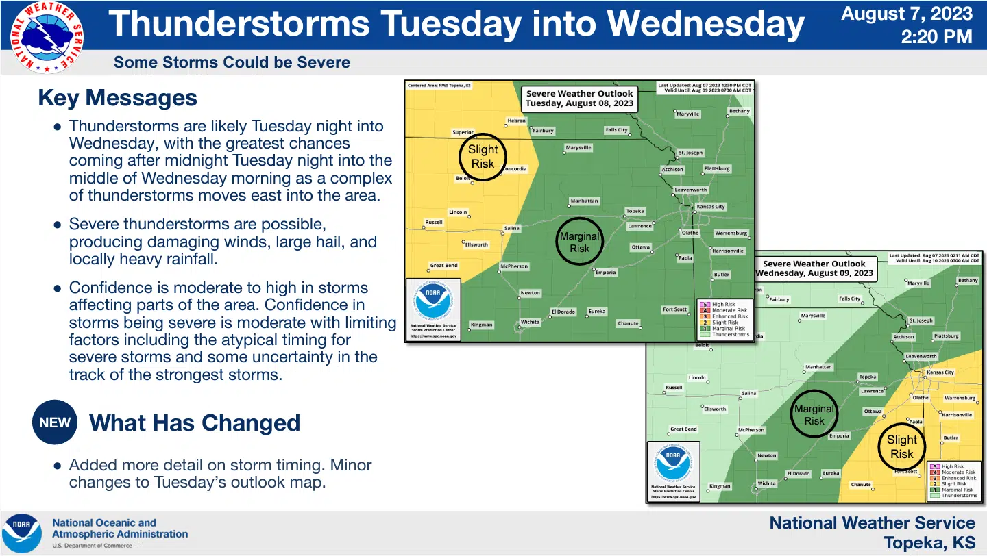
Chances for severe thunderstorms remain in place for the entire KVOE listening area late Tuesday into early Wednesday.
A marginal risk is in place areawide for Tuesday night with forecasts calling for a marginal-to-slight risk early Wednesday. The main hazards continue to be damaging wind, large hail and heavy rainfall over the next 24-hours.
The greatest chances for storm activity is between midnight and 3 am Wednesday with lower chances through the early morning hours.
The storm chances will bring with them continued relief from oppressive heat that affected the area for the past two weeks. Temperatures in the upper 80s to low 90s will be commonplace between Tuesday and next Monday with occassional chances for more storm activity prevelant through that same time period.
Stay with KVOE, KVOE.com and KVOE social media for updates.
8:55 am Tuesday: WEATHER: Overnight storms could bring heavy rainfall, isolated severe weather
High temperatures in the low 90s Tuesday will give way to thunderstorm chances late Tuesday night through much of Wednesday morning.
Currently, there is a marginal risk of severe weather areawide for Tuesday night and a marginal-to-slight risk west to east for Wednesday morning. Damaging wind, large hail and locally heavy rainfall are the main hazards with both time periods, but graphical information from the National Weather Service indicates the best chances of rain and storms locally will be between 3 am and noon.
Once the storms clear the area, Wednesday will see highs in the mid-80s — and high temperatures will be in the 80s or low 90s into early next week. Slight to moderate chances of storms return Thursday night and continue through at least Monday.
Stay with KVOE, KVOE.com and KVOE social media for updates.
 (1)")


")