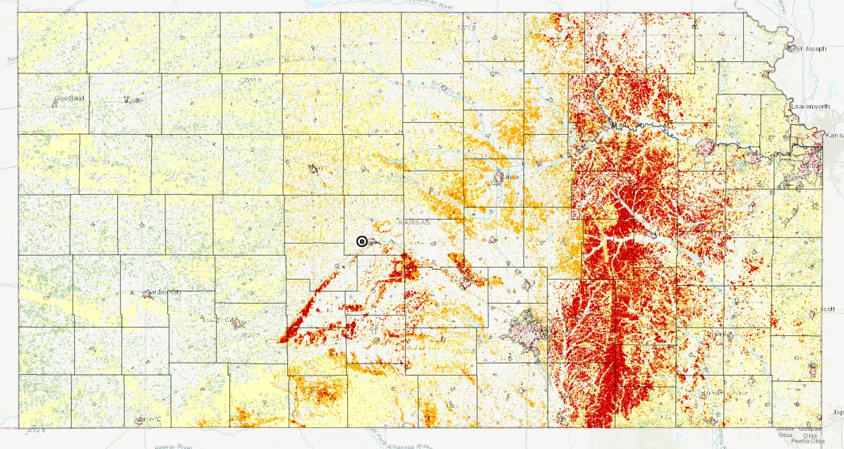
With drought ongoing and the fall wildfire season beginning as a result, the Kansas Forest Service has unveiled a new tool so residents across the state can gauge their risks from grass fires, depending on where they live.
Kansaswildfirerisk.org is the culmination of years worth of research, using data from ground level and satellites to pinpoint risk areas due to a variety of factors like invasive plant species and areas near city limits — also called the “wildland-urban interface.” It also comes to fruition after massive grass fires that burned nearly 300,000 acres in south-central Kansas in 2016 and over 450,000 acres in southwest Kansas in 2017.
The website revolves around the Risk Explorer, which lets residents click on a button, view a map, move the map to gauge the risk and download the report. Much of the KVOE listening area — as well as a block of land generally from Wichita to north of Milford Lake on the west side and south of Lawrence on the east side — is in an extreme risk area.
Kansaswildfirerisk.org also has other information, including pages on preparedness, financial assistance for wildfire defense initiatives, prevention, fire suppression and the National Fire Danger Rating System including state and national forecast data.


