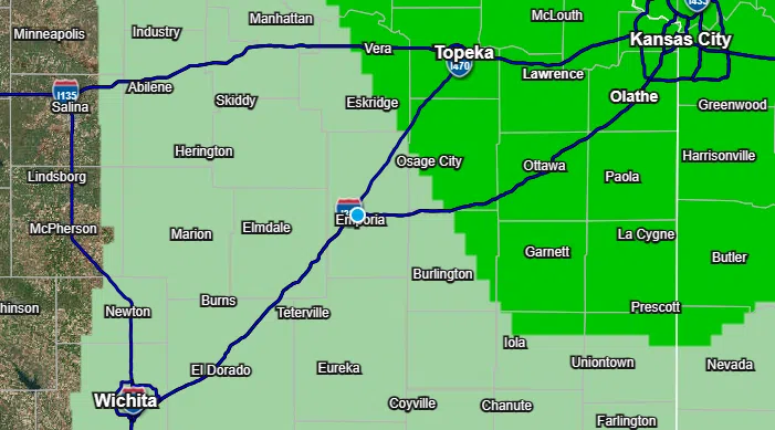
Parts of the KVOE listening area have severe weather risks both for Easter evening and Monday, although the threat levels are as low as possible for both periods.
The National Weather Service originally limited Sunday’s marginal severe weather risk to northeast Kansas but expanded it to include most of Osage and northeast Coffey counties. Hail up to 1.5 inches in diameter, or the size of ping pong balls or walnuts, and wind gusts up to 60 mph are the main risks after sunset, but the overall chances of storm activity are currently under 30 percent.
A marginal severe weather risk also impacts areas just southeast of the Kansas Turnpike for Monday afternoon and evening, involving hail up to 2 inches in diameter and damaging wind as the lead concerns.
Stay with KVOE, KVOE.com and KVOE social media for updates.
6:20 am Sunday:
Strong to severe thunderstorms are possible for parts of the KVOE listening area Monday, but it currently appears the more notable threat will be to our southeast.
Storms are expected to develop Monday afternoon. The latest from the Storm Prediction Center has a marginal risk for areas just southeast of the Kansas Turnpike. Far southeast Greenwood County is in a slight risk, while the southeast corner of Kansas is in an enhanced risk.
Hail up to 2 inches in diameter, or egg size, and damaging winds are the main concerns.
Storms are expected to fire along a frontal boundary. The National Weather Service says there is still some uncertainty in the forecast models for Monday, including some potential for pushing the severe weather risk further to the northwest — thus involving more of the KVOE listening area.
KVOE and KVOE.com will have updates as warranted.


