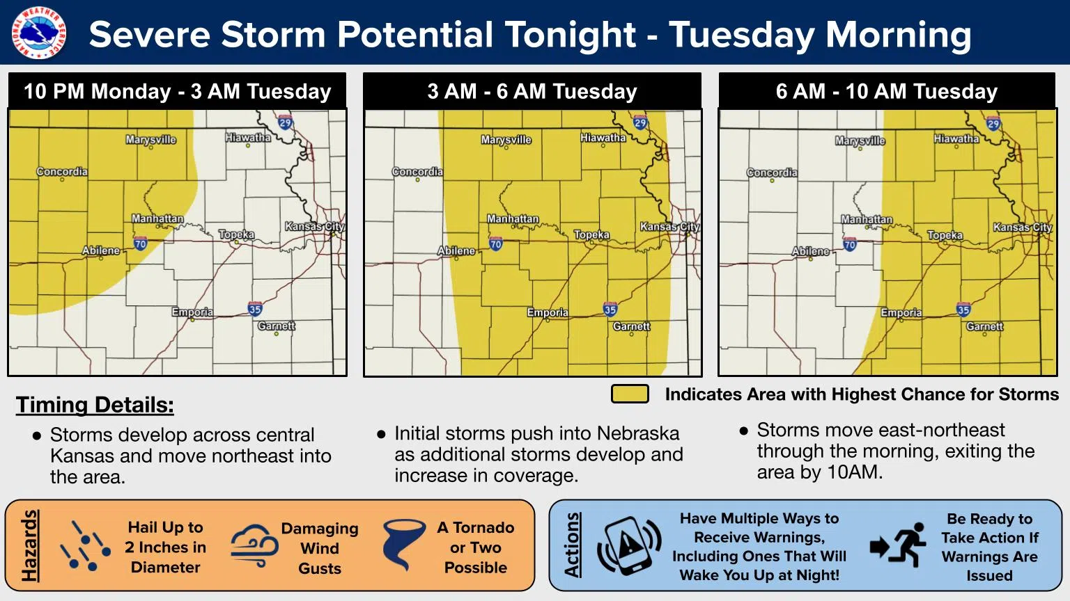
Thunderstorms appear likely and severe weather is possible for the KVOE listening area beginning late Monday night.
Storms will likely enter the area after midnight, and it may actually be after 2 am before storms start affecting us. With the timing, TV-13 meteorologist Doug Meyers says you need to be ready — especially in how you get your weather alerts.
There is currently a slight severe weather risk areawide, basically from midnight to sunrise. The risk diminishes to marginal for the sunrise to mid-morning hours Tuesday before the severe weather risk moves completely out of our area.
The risk for severe weather follows a burst of record heat locally. Sunday’s official high temperature was 91 degrees at the Emporia Municipal Airport, topping the previous record of 90 degrees set in 2006. Saturday got to 90 degrees, but fell short of the ongoing daily record high of 96 degrees — also in 2006.
Be sure to stay with KVOE, KVOE.com and KVOE social media for updates.
6:45 pm Sunday: Latest round of severe storm activity expected for listening area late Monday through early Tuesday
Severe storm activity will be a concern for the entire KVOE listening area late Monday into early Tuesday.
The National Weather Service currently has the entire listening area in a slight risk category with high winds and large hail being the main concerns. Chances for tornadic activity are low, but cannot be completely ruled out at this time.
Severe storm chances will continue into Tuesday, however, the majority of the listening area is only in a moderate risk category for that time frame. The same primary hazards are expected with any storms that develop with the most likely time for development coming between the morning and mid-afternoon hours.
NWS anticipates any storm activity should move out of the area before the early evening hours.
Heavy rainfall is also expected with any storms that develop. KVOE will have regular updates as necessary on KVOE, KVOE.com and KVOE social media.


