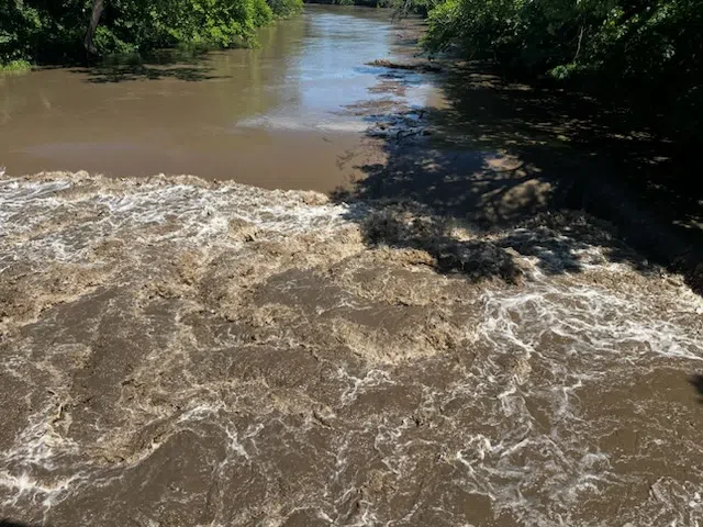
Minor flooding is underway at one area gauge and close to beginning at others after heavy rainfall early Sunday.
Flooding began along the Cottonwood River at the Cottonwood Falls gauge shortly before 7 pm. The river was at 9.1 feet, just above the 9-foot flood stage. It should climb to 11 feet by shortly after sunrise Monday and go below flood stage by Monday evening. Moderate flooding is expected.
For the Cottonwood at Emporia, flooding appears likely soon. The river was at 19 feet at 6:15 pm, just under flood stage of 20 feet. The current forecast has the river cresting at 25.9 feet Monday evening and going below flood stage Wednesday. The river’s flood warning currently extends to Wednesday afternoon. Moderate flooding is expected.
The Cottonwood at Plymouth is in a flood warning until early Wednesday. It reached 31.84 feet at 7 pm Sunday. The current projection has the river cresting at 33.5 feet early Monday afternoon and go below flood stage Tuesday afternoon. Minor flooding is anticipated,
The Neosho River at Neosho Rapids is also in a warning until early Wednesday afternoon. The river reached 18.57 feet at 7:15 pm Sunday. It’s now expected to reach 24.4 feet early Tuesday morning and should go below flood stage shortly after sunrise Wednesday. Minor flooding is expected.
3:45 pm Sunday: Minor adjustments to river-based warning times, projected crests
Flood warnings are starting to get eliminated for parts of the KVOE listening area — if they involve counties.
The National Weather Service has allowed warnings for south Lyon and northeast Coffey counties to expire. The warning for Chase County, meanwhile, has been extended and now doesn’t end until 10 am Monday.
Some river-based flood warnings west of Emporia have been extended, while others remain as initially announced. The latest list:
*Cottonwood at Emporia: Sunday evening to Wednesday evening. River at 2:30 pm Sunday was at 16.91 feet and pushing towards crest of 25.9 feet early Monday. River should go below 20-foot flood stage early Wednesday morning. Kansas Highway 99 south bank begins flooding at 24 feet. K-99 north bank begins flooding at 25.5 feet. River reaches low steel on Old K-99 bridge at 26.5 feet.
*Cottonwood at Plymouth: Until Wednesday. River at 3 pm Sunday was at 31.52 feet, just shy of 32-foot flood stage, and climbing towards a projected crest of 33.50 feet Monday afternoon. River is forecast to go below flood stage Tuesday night. River inundates Road A near the river gauge site at 34 feet.
*Cottonwood at Cottonwood Falls: Until early Tuesday afternoon. River at 2:40 pm was at 8.7 feet, just below flood stage of 9 feet. River should crest at 11 feet Monday morning and go below flood stage Tuesday morning. Main Street, also known as Lake Road, begins flooding low-lying areas between Cottonwood Falls and Elmdale at 12 feet.
*Neosho at Neosho Rapids: Sunday evening to late Wednesday evening. River at 2:30 pm Sunday was at 16.12 feet and should crest at 25.1 feet early Tuesday morning. River should go below flood stage early Wednesday. Water overtops Road 145 near the Neosho River bridge at 23 feet.
*1400 block Prairie
*Road 140 between J and Kansas Highway 99
*Road 150 from H to J; from J to Kansas Highway 99; from N to R
*Road 160 from N to P; from R to S
*Road G from 160 to 170
*Road J between 140 and 160
*Road K between 140 and 155
*Road N from 160 to 170
*Road P from 140 to 170
*Road R from 160 to 1170
*Road S from 150 to 170
KVOE, KVOE.com and KVOE social media will update the flooding situation for the duration of this event. If you have rain totals from Sunday morning, message the Bluestem Farm and Ranch text line at 620-342-5863.
12:30 pm Sunday: River-based flood warnings up for Cottonwood, Neosho rivers near Emporia
River-based flood warnings now affect the Cottonwood and Neosho rivers near Emporia after anywhere from 2-6 inches of rain early Sunday.
The National Weather Service originally had county-specific flash flood or flood warnings affecting Lyon, Chase, Coffey and Marion counties, and county-specific flood warnings continue for Chase County until 4 pm and northeast Coffey County until 1 pm. However, a long list of river-specific flood warnings are now active for the KVOE listening area. The latest details can be found above.
As a result, numerous Lyon County roads are closed until further notice. That list can be found above as well.
Emporia’s Mechanic Street underpass was closed for much of the early-morning period Sunday but has reopened.
Elsewhere across the KVOE listening area, the Chase County Sheriff’s Office reports at least 10 roads that are closed due to flooding as of 12:30 pm. Coffey County continues to assess its situation but currently has no confirmed flood-related closures. Greenwood and Osage counties have no closures to report.
Hard rain came in waves to much of the KVOE listening area between midnight and sunrise, leading to a lot of heavy rain reports, especially in and immediately around Emporia:
*KVOE studios: 4.50 inches
*Emporia Municipal Airport: 2.21 inches
*300 block Arundel: 4 inches
*800 block Whildin: 4.75 inches
*900 block Grand: 5.50 inches
*1100 block Constitution: 4.50 inches
*1300 block State: 6 inches
*1800 block Coronado: 3.75 inches
*3500 block West 22nd: 3.50 inches
*Fifth and Garfield: 3.50 inches
*Ninth and Burns: 4.50 inches
*Ninth and Sunnyslope: 4 inches
*10th and Weaver: 4.50 inches
*10th and Whildin: 4 inches
*15th and Thompson: 4 inches
*18th and Prairie: 4.10 inches
*Fanestil Drive: 5.25 inches
*West Ridge Drive: 6 inches
*Willow Lane: 3.50 inches
*700 block Road 200: 2.96 inches
*1200 block Road 220: 4.50 inches
*4 miles north-northeast of Emporia: Estimated 4.90 inches
*7 miles north of Emporia: 4.25 inches
*1 mile northwest of Emporia: 3.65 inches
*2 miles northwest of Emporia: 2.69 inches
*3 miles northwest of Emporia: 3 inches
*5 miles east-southeast of Emporia: 2.30 inches
*5 miles south-southwest of Emporia: 2.23 inches
*7 miles southwest of Emporia: 2.80 inches
*Roads 140 and C: 3.20 inches
*Americus: 4.30 inches
*Maple Street, Americus 5.50 inches
*7 miles east of Americus: 3.96 inches
*2 miles south of Beto Junction: 3.75 inches
*Burlington: 1.65 inches
*Bushong: 1.02 inches
*Gridley: 2.39 inches
*Kansas Highway 99 and Road P: 3.80 inches
*Hartford: 1.65 inches
*Lake Kahola: 2.71 inches
*4 miles southwest of Miller: 1.10 inches
*Olpe: 3.50 inches
*200 block Anderson, Olpe: 3.50 inches
*8 miles east-southeast of Olpe: 2.03 inches
*Reading: 1.85 inches
*Thorndale: 4.20 inches
*1 mile east of Thorndale: 3 inches
6:30 am Sunday: Several Lyon County roads closed due to flooding rainfall
Heavy rain forced Emporia and Lyon County officials to close several roads between midnight and sunrise Sunday.
The KVOE studios got 4.4 inches of rain between midnight and 5 am, while the Emporia Municipal Airport got 2.06 inches in the same time frame. That led to the following closures:
*Emporia’s Mechanic Street underpass
*1400 block Prairie
*Road 140 between J and Kansas Highway 99
*900 block Road 150
*Road 150 between J and Kansas Highway 99
*Road J between 140 and 160
*Road K between 140 and 155
Severe thunderstorm watches for Chase and Greenwood counties were canceled before their original expiration times with no severe weather reports. However, the southern half of Lyon County — including Emporia, Hartford, Neosho Rapids and Olpe — had a flash flood warning initially extended before shifting to a flood warning ending at 11:30 am. Northeast Coffey County, including Beto Junction and Waverly, are in a separate flash flood warning that now ends at 9 am. Chase County is in a flood warning until 9 am.
High waters in Emporia led to a reported water rescue in the 100 block of South Walnut. Details are pending through Emporia Fire.
As of 5:30 am, there are less than 30 Evergy customers in the KVOE listening area without power due to the storms. The number had been over 100, with the vast majority of outages in the Emporia city limits.
KVOE, KVOE.com and KVOE social media will keep you updated as the weather situation unfolds. If you have rain reports, please message them to the KVOE Bluestem Farm and Ranch text line at 620-342-5863.
*Click here for a YouTube Short video.
2:20 am Sunday: Torrential rainfall leads to flood warnings, closed roads
After high winds were the main focus of overnight storms Saturday, torrential rainfall has become the main concern with overnight storm systems Sunday.
At the KVOE studios, we received 3.7 inches of rainfall in just over an hour after storms began shortly after midnight Sunday bringing the weekend total to 4.4 inches on top of the 0.70 inches noted with the early morning storms Saturday.
A flash flood warning is in effect for Southern Lyon County, impacting Emporia, Hartford, Neosho Rapids and Olpe, until 5:15 am. A separate flash flood warning for Northeastern Coffey County goes until 5:45 am and a flood warning for all of Chase County is in effect until 9 am.
Road closures have begun as a result of the heavy downpours. In Emporia the Mechanic Street underpass has been closed to traffic.
Other closures include:
*Prairie Street between Prairie Park Lane and 15th Avenue
*900 Road 150
Emporia Fire was called out just after 2:15 am for a water rescue at 114 South Walnut Street. Emergency traffic indicates a vehicle was stuck in the water with at least two individuals inside. Further details are pending.
In addition, over 100 Evergy customers lost power as part of scattered outages across Emporia early Sunday.
Stay with KVOE, KVOE.com and KVOE social media for more weather updates as they develop.


