


Old Man Winter is set to flex his muscles this week.
Moderate to heavy snow Monday night through Tuesday is set to combine with brutally cold air that may not start easing until Friday.
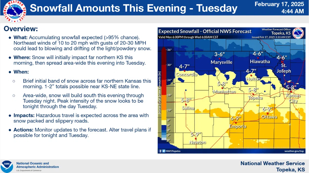
Winter storm watches have been upgraded to winter storm warnings for all area counties, with cold weather watches also upgraded to warnings areawide. National Weather Service meteorologist Matt Flanagan says we could see up to 9 inches of snowfall by late Tuesday night, coupled with northeasterly winds as high as 30 mph to bring near-blizzard conditions and widespread drifting to the area. The Weather Service lists peak intensity times at between 6 am and 6 pm Tuesday.
Extremely cold air moves in at the same time.
Travel, as you can imagine, is not recommended.
If you absolutely have to travel by vehicle, have an emergency kit ready, with suggested items including blankets, bottled water, non-perishable food, cell phone charger, ice scraper, jumper cables, flashlight with working batteries and a first-aid kit.
Numerous schedule adjustments have been announced. Click here for the complete list.
Also, the city of Emporia has announced the now-standard list of warming center locations, including the Emporia Police Department entryway, Lyon County Sheriff’s Office lobby, Emporia Public Library, First Congregational Church, First United Methodist Church, Twelfth Avenue Baptist Church and Bloom House Youth Services. Hours of operation and different policies for people and pets apply. Click here for the updated list.
Be sure to stay with KVOE, KVOE.com and KVOE social media for updates on weather, travel and schedule adjustments. If you have schedule adjustments to add to our list, call KVOE at 620-342-1400, message the Bluestem Farm and Ranch text line at 620-342-5863 or email kvoe@kvoe.com.


