


Borderline severe thunderstorms are unlikely but possible Monday evening.
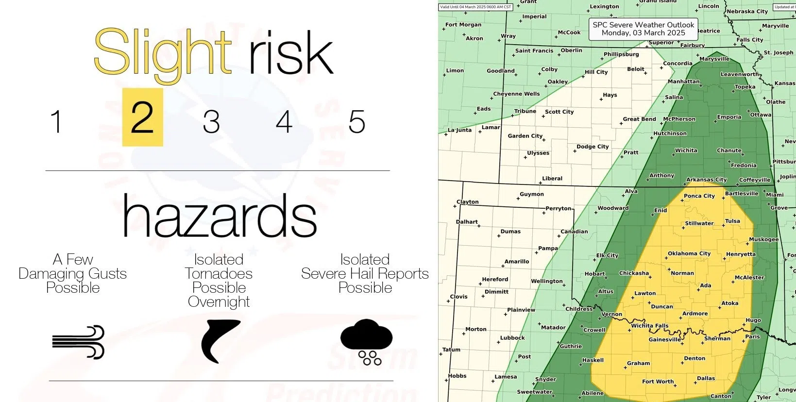
The Storm Prediction Center has expanded a marginal severe weather risk to include Lyon and all surrounding counties after having the southern half, along with Emporia, included in Saturday’s late-night outlook. Hail and wind remain as the concerns.
Stay with KVOE, KVOE.com and KVOE social media for updates.
12 am Monday: Marginal severe weather risk Monday evening for hail, wind
It doesn’t cover the full KVOE listening area, and it’s as low as it gets, but Monday evening presents the first severe weather risk outlook for parts of the area.
Forecasts provided by the Storm Prediction Center on Saturday indicate a marginal severe weather risk for areas along and south of the Kansas Turnpike and Interstate 35. Wind and hail are the main concerns.
The risk area has been outlined as the National Weather Service is tentatively set to begin its storm spotter training sessions for area counties — at 6:30 pm Monday at Eureka High School’s auditorium. It also comes with the state’s Severe Weather Awareness Week kicking off Monday.
The current forecast calls for a good chance of rain Monday night through Tuesday evening before a rain-snow mix Tuesday night. Slight chances of rain return Thursday night through Friday night.
KVOE will have live on-air and online updates whenever severe weather threatens or is underway areawide, with social media alerts through Facebook, Instagram and X. As has been the case for years, our coverage will be enhanced with information from the volunteer KVOE Storm Team spotter network.


