


There is a lot of wind coming to the KVOE listening area the next two days — meaning a lot of wind-related alerts for area counties.
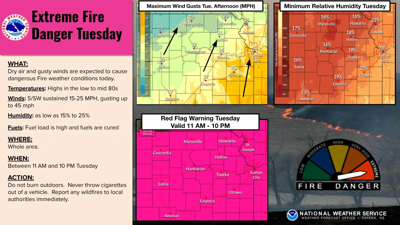
Tuesday is a red flag warning day areawide, meaning outdoor burns are disallowed while the warning is active from 11 am to 10 pm. Lyon, Coffey, Morris, Osage and Wabaunsee counties are in a wind advisory from 9 am Tuesday to 4 am Wednesday before shifting to a high wind warning from 4 am to 7 pm Wednesday. Chase County has a high wind warning from 1 am to 7 pm Wednesday, while, Greenwood County has a wind advisory from 9 am Tuesday to 7 pm Wednesday.
National Weather Service meteorologist Nathan Griesemer says winds could be close to 40 mph Tuesday, along with temperatures in the 80s, low humidity levels and dry grasses. Winds could be near 60 mph Wednesday, but conditions will be more wintry with falling temperatures through the day and light snowfall. Regardless of the spring-like conditions Tuesday and the brief return to winter Wednesday, Griesemer says people need to be careful.
Blizzard or near-blizzard conditions are setting up for western and north central Kansas, as well as much of Nebraska and Iowa, but Griesemer doesn’t expect that kind of weather activity here — simply because snow totals should be under an inch. However, power outages are possible both days. The Weather Service also advises people to watch for falling debris and tree limbs, especially Wednesday.
Stay with KVOE, KVOE.com and KVOE social media for updates.


