


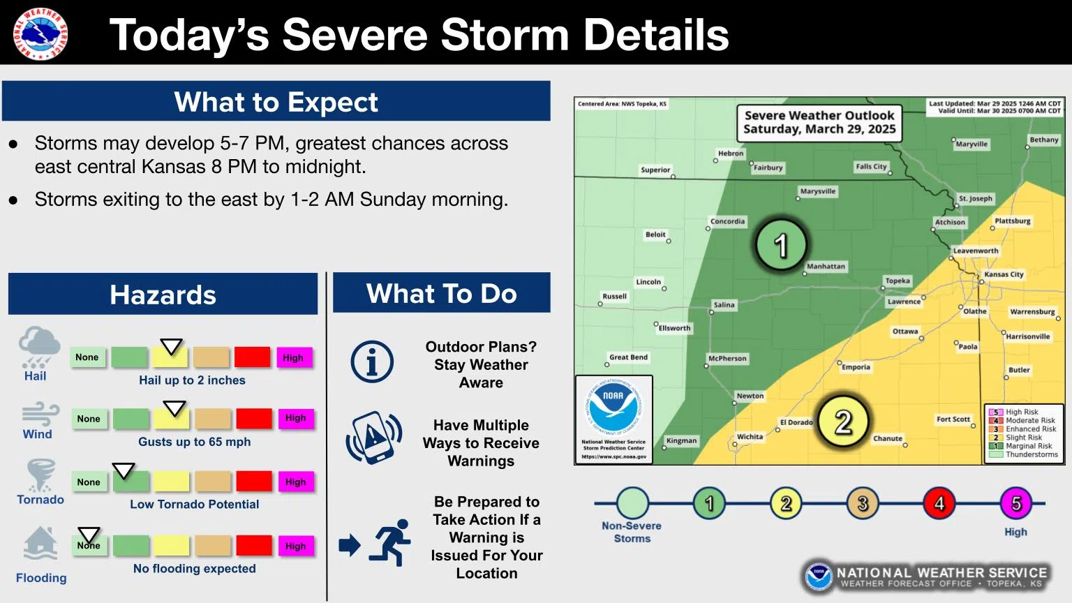
Strong and severe thunderstorms are possible areawide Saturday evening into very early Sunday.
The Storm Prediction Center’s risk outlook map has changed somewhat from Friday’s projections. Throughout Friday, all area counties were in a slight severe weather risk for all hazards, with the main concerns being wind and hail. Area counties now have a marginal-to-slight risk for Saturday, with areas along and south of a line from near Cedar Point to near Burlingame in the slight risk area.
Hail up to egg size or 2 inches in diameter, along with storm gusts up to 65 mph, are the concerns areawide. The marginal tornado risk has been shifted south of our area.
Storms may develop before sunset and move into the area by mid-evening.


