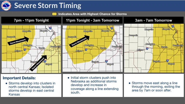
Severe weather in several forms remains possible through the overnight hours early Wednesday.
A tornado watch now covers all area counties until 7 am. Storms along a squall line have already produced high wind, hail and tornadoes, and that trend could continue until around sunrise.
Be sure to stay with KVOE, KVOE.com and KVOE social media for updates. We will have on-air and online updates as warranted, and we will also have social media alerts on Facebook, Instagram and X. We will also have “ground truth” reports from the KVOE Storm Team spotter network.
6 am Tuesday: Two rounds of severe weather possible Tuesday night
No fooling — there could be a lot of severe weather across the Central Plains on Tuesday, including the KVOE listening area.
TV-13 meteorologist Doug Meyers says there could be isolated severe storms developing ahead of a line of severe storms as the night progresses. Current projections have isolated storms across the Flint Hills by 8 or 9 pm, with the line possibly by midnight or later.
There is an enhanced risk for severe weather Tuesday night. Overlapping that is a wind advisory for Lyon, Chase, Greenwood, Morris and Wabaunsee counties from 10 am Tuesday to 1 am Wednesday as winds gust above 40 mph.


