


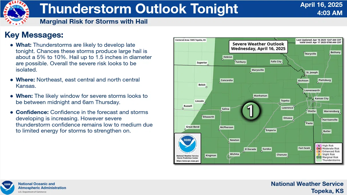
Area residents have a chance of severe weather early Thursday.
Storms are a good bet from midnight to sunrise. Currently, there is a marginal severe weather risk during that time period. Initially, the main concern was for quarter-sized hail. Now the main concern is hail to the size of ping pong balls or walnuts.
Another marginal risk area has been outlined for all area counties Friday evening into Saturday morning. Hail and wind are the main concerns for that time period.
There is also a moderate to likely chance for rainfall for the Easter weekend. Current projections have over an inch of total rainfall possible areawide for Saturday and Sunday.
With rain appearing more likely as the week progresses, fire danger is still a concern — at least in the short term. Temperatures in the mid-90s and gusty south winds between 30-40 mph will lead to a very high fire danger for areas along and west of a line from Harveyville to Neosho Rapids to Madison for Thursday.
KVOE and KVOE.com will have updates.


