


Our dry weather pattern that’s been months in the making could be reversing, if only for the short term.
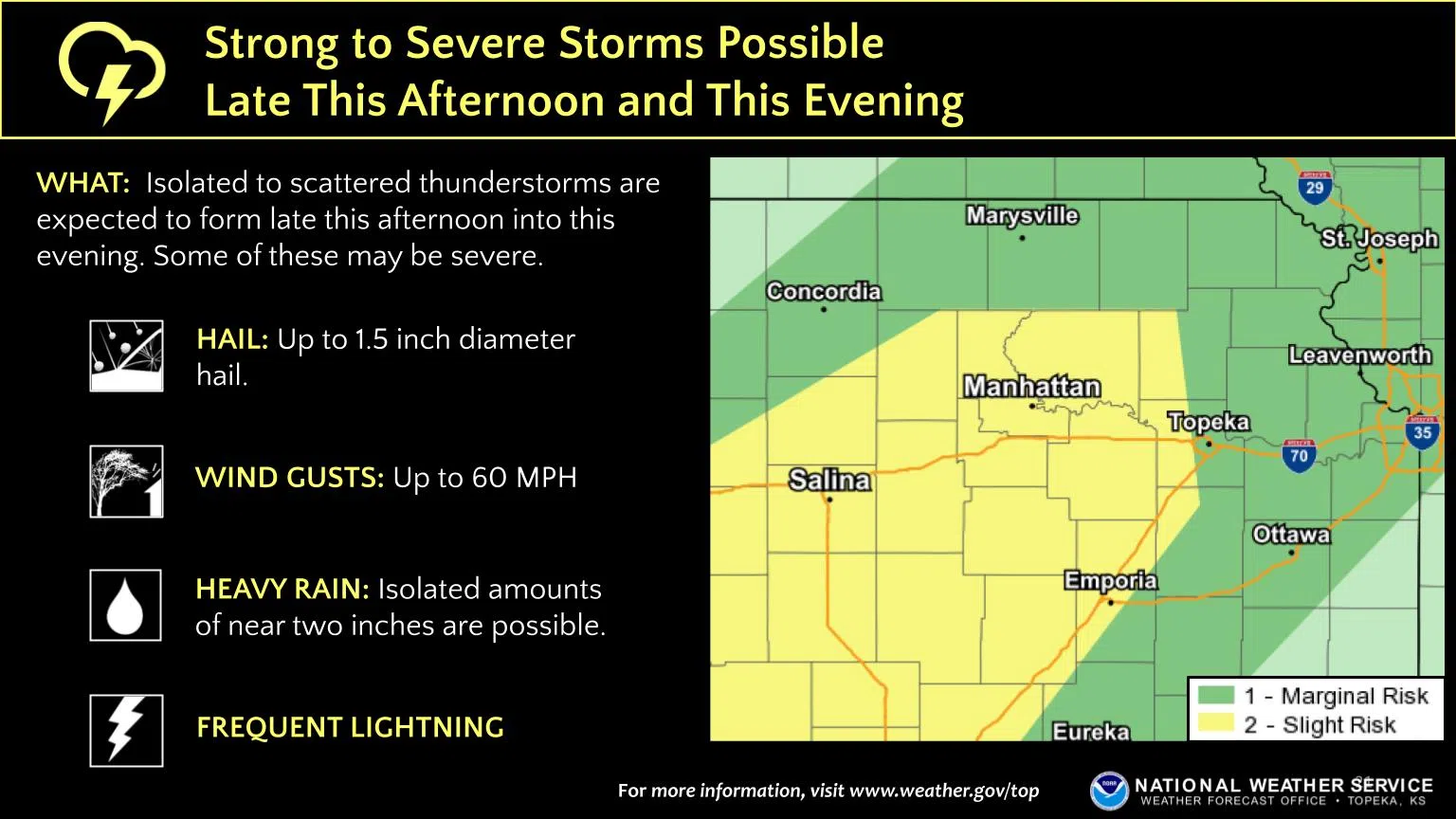
Numerous chances for showers and storms are in the forecast through early next week. Tuesday should be dry through the day with sunshine and temperatures climbing to 80 degrees, but showers and storms could move across the area by early evening. There is currently a marginal-to-slight severe weather risk for hail to the size of ping pong balls or walnuts and wind up to 60 mph areawide, with areas along and west of a line from Carbondale to Reading to Teterville in the slight risk area. Heavy rain is possible, with pockets of rainfall up to two inches at least possible.
There is also a marginal risk for severe wind and hail for Wednesday. With at least slight chances for showers and storms through Monday, the National Weather Service is also mentioning concerns of localized flooding by the time things clear out next week.
The short-term severe weather threat also comes as the Weather Service’s weather radio transmitter near Halls Summit is offline. There is no current word about a cause and there is no word on a repair timetable. The transmitter serves Lyon, Coffey, Osage and parts of Chase, Greenwood, Morris and Wabaunsee counties.
There are neighboring transmitters that cover at least parts of the affected areas:
*WZ2512 at Parker. Broadcasts on channel 6 or frequency 162.525 MHz
*WXK95 at Chanute. Broadcasts on channel 1 or frequency 162.400 MHz
*KID77 at Kansas City. Broadcasts on channel 7 or frequency 162.550
*WXK91 at Topeka. Broadcasts on channel 4 or frequency 162.475 MHz
KVOE and KVOE.com will keep you updated.


