


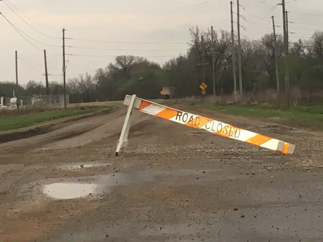
Heavy rainfall this week has closed a few Lyon County roads.
Lyon County Emergency Communications reports isolated road closures near Emporia as the result of rainfall:
*Road 150 between Roads D and E; between Kansas Highway 99 and Road J; between Roads N and P
*900 block Road 140
*1400 block Road J
*1400 block Road K
*Road P between Roads 140 and 150
This follows anywhere from light to extremely heavy rainfall from storms just Monday night into Tuesday, with anywhere from 0.25 to over 5 inches of rainfall reported. Places around Emporia got upwards of 1.5 inches of rain Sunday as well.
How the rain this week impacts the US Drought Monitor’s weekly update map issued Thursdays remains to be seen this week.
Both rounds of storms brought isolated small hail to portions of the area. Monday evening’s storms also brought two weak, short-lived tornadoes to central Wabaunsee County between Alta Vista and Eskridge.
The current forecast indicates dry conditions until Friday afternoon, with chances of showers and storms through Memorial Day.
8:30 am Tuesday
For the second straight night, thunderstorms brought heavy rain and small hail to the KVOE listening area.
And for the second straight night, storms failed to bring any confirmed severe weather despite several warnings for area counties.
Isolated to scattered storms eventually congealed into a squall line that moved slowly across the area — and also dissipated as it approached Emporia. More rain came as part of non-severe activity after midnight.
*KVOE studios: 2.20 inches
*Emporia Municipal Airport: 3.09 inches
*3 miles east of Emporia Municipal Airport: 2.40 inches
*3.5 miles west of Emporia Golf Course: 2.80 inches
*Ninth and Burns: 2 inches
*Ninth and Lawrence: 1.55 inches
*South and Sylvan: 1.90 inches
*10th and Weaver: 2.05 inches
*300 block Arundel: 2 inches
*1100 block Constitution: 2.20 inches
*Coronado Avenue: 2 inches
*Deerbrook Addition: 1.90 inches
*Meadowlark: 2.75 inches
*1 mile northeast of Emporia: 1.41 inches
*Allen: 2.40 inches
*Americus: 1.25 inches
*4.5 miles north of Bazaar: 2.20 inches
*Bushong: 1.95 inches
*Cottonwood Falls: 2.25 inches
*Council Grove: 1.75 inches
*Council Grove City Lake: 1.80 inches
*Council Grove Lake: 1.62 inches
*6 miles north of Gridley: .040 to 0.75 inches
*Between Hartford and Olpe: 0.75 inches
*Kansas Highway 99 at Lyon-Greenwood County line: 1.20 inches
*Lake Kahola: 2 inches
*2 miles north of Lebo: 0.50 inches
*Neosho Rapids: 1.60 inches
*Olpe: 2.10 inches
*Olpe Blacksmith Shop: 2.40 inches
*1 mile east of Olpe: 2 inches
*1 mile southwest of Olpe: 2.50 inches
*5 miles southwest of Olpe: 3.40 inches
*Southwest of Olpe: 2.50 inches
*Reading: 1.50 inches
*Road 130 2.5 miles east of Kansas Highway 99: 3.60 inches
*Roads 170 and T-5: 2.25 inches
*1 mile north of Saffordville: 3 inches
*Strong City: 4 to 5.125 inches
*1.5 miles east of Thorndale: 2.40 inches
*Toledo: 1.06 inches
The heavy rainfall caused a flash flood warning for portions of northwest Lyon, southeast Morris and southwest Wabaunsee counties, as well as a flood warning for part of Chase County. Also, Lyon County Emergency Communications reports isolated road closures near Emporia as the result of rainfall:
*Road 150 between Kansas Highway 99 and Road J
*900 block Road 140
*1400 block Road J
*1400 block Road K
Storms formed in an atmosphere thought of as conducive for all severe weather hazards, and there were pea-sized hail reports in Olpe and near the Emporia Golf Course. The Wabaunsee County Sheriff’s Office says there were two small, short-lived tornadoes, including one that touched down about seven miles east of Alta Vista and another that touched down near Eskridge. One residence with outbuildings was damaged. No injuries were reported.
Sunday evening saw no tornadoes in Lyon or nearby counties, but there was rainfall up to 1.5 inches in Emporia and isolated small hail.
If you have rain totals or storm reports, message the KVOE Bluestem Farm and Ranch text line at 620-342-5863.
1:45 pm Monday: Tornado watch in place for entire KVOE listening area through 9 pm Monday
The eastern half of Kansas is now under a tornado watch until Monday evening including the entire KVOE listening area.
The tornado watch effects Lyon and all surrounding counties until 9 pm Monday. According to the latest forecast details from the National Weather Service, severe storm activity could begin developing in the mid-afternoon hours along a dryline making its way across the area into the early evening hours.
On top of the risk for tornadic activity, storms could also bring damaging winds, large hail, up to the size of apples, and heavy rainfall, which could lead to concerns of isolated flooding before all is said and done. The Storm Prediction Center has most of the KVOE listening area in an enhanced, or level 3 risk. Far southeast Coffey and Greenwood counties are in a moderate, or level 4 risk.
Be sure to stay with KVOE, KVOE.com and KVOE social media for updates. If you have not already signed up for alerts through KVOE’s social media platforms, find us on Facebook, Instagram and YouTube, all @kvoenews, and on X@kvoeam1400. The KVOE volunteer Storm Team spotter network is set to provide reports during our coverage.
11:30 am Monday:
Severe weather is possible areawide for much of the rest of Tuesday.
Current indications are isolated to scattered storms could develop by mid-afternoon, followed by storms along a dryline moving across the area by late afternoon or early evening. All hazards are possible, with more widespread coverage of severe weather along the dryline. The greater risk of tornadic activity is with isolated or scattered storms earlier in the day, although there could still be short-lived spin-up tornadoes along any squall line from early to late evening.
Storms could return to the area by late Tuesday night but should clear the area by sunrise, if not sooner.
The Storm Prediction Center has most of the KVOE listening area in an enhanced, or level 3 risk. Far southeast Coffey and Greenwood counties are in a moderate, or level 4 risk.
Be sure to stay with KVOE, KVOE.com and KVOE social media for updates. If you have not already signed up for alerts through KVOE’s social media platforms, find us on Facebook, Instagram and YouTube, all @kvoenews, and on X@kvoeam1400. The KVOE volunteer Storm Team spotter network is set to provide reports during our coverage.
7:30 am Monday
Area residents are under an enhanced severe weather risk for the second straight day.
All hazards are possible, including egg-sized hail, wind gusts as high as 70 mph and tornadoes. National Weather Service meteorologist Bill Gargan expects a round of isolated severe weather before mid-afternoon before more widespread activity along a dry line by late afternoon or early evening. He also expects some severe weather alerts through the afternoon and evening, but he says the tornado risk depends on whether storms are spread out or congealed into a line.
On Sunday, a broken line of storms dropped heavy rain across parts of Lyon County — over an inch of rain in under 45 minutes at the KVOE studios — leading to the brief closure of the Mechanic Street underpass and several reports of street ponding across Emporia. Rain totals
*KVOE studios: 1.20 inches
*Emporia Municipal Airport: 0.71 inches
*3 miles east of Emporia Municipal Airport: 0.73 inches
*3.5 miles west of Emporia Golf Course: 1.50 inches
*Ninth and Lawrence: 1.30 inches
*10th and Weaver: 1.25 inches
*18th and Briarcliff: 1 inch
*1100 block Constitution: 1.50 inches
*South and Sylvan: 1.40 inches
*600 block Road 110: 1.40 inches
*Allen: 0.10 inches
*Americus: 0.50 inches
*Council Grove City Lake: 0.50 inches
*Between Hartford and Olpe: 0.20 inches
*Lamont: 0.30 inches
*Neosho Rapids: 1 inch
*Southwest of Olpe: 0.40 inches
*Reading: 0.75 inches
*Thorndale: 1.30 inches
Storms also caused an expansive power outage from far east Emporia to Olivet, sending over 100 rural Evergy and nearly 60 4 Rivers Electric Cooperative customers offline. Outages have been restored.
Large hail, the main concern for a potential multi-hazard situation, never materialized areawide. Pea-sized hail was reported near 10th and Weaver.
Also, Emporia Fire/EMS responded to a reported injury crash at Kansas Turnpike mile marker 106 southbound after a rollover was reported in rainy conditions. Emergency responders observed three patients, two adults and a child, with none of the people in the vehicle going to a hospital by ambulance.
Different first responders joined Kansas Highway Patrol troopers at a separate crash site near the Turnpike’s Matfield Green service exit. A northbound SUV driven by 28-year-old Brenda Del Real of Topeka lost control and slid into the inside lane where it was hit by a semi driven by 25-year-old Beksultan Mamadrazakov of Los Angeles. Del Real was taken to Newman Regional Health with suspected minor injuries while Mamadrazakov was not hurt.
Be sure to stay with KVOE, KVOE.com and KVOE social media for updates. If you have not already signed up for alerts through KVOE’s social media platforms, find us on Facebook, Instagram and YouTube, all @kvoenews, and on X@kvoeam1400. The KVOE volunteer Storm Team spotter network is set to provide reports during our coverage.


