


Blustery conditions anticipated Saturday have led to a wind advisory for Lyon, Chase and Morris counties.
The National Weather Service has issued a wind advisory from 9 am to 6 pm. Wind gusts of up to 40 mph are possible, potentially leading to travel issues for high-profile vehicles and isolated power outages.
KVOE and KVOE.com will have updates.
7:45 am Friday:
The first half of the Thanksgiving holiday weekend has had pleasant and seasonal fall conditions. The back half brings us our first taste of winter for the season.
After temperatures in the mid- and upper 40s Thursday and Friday, light rain develops before sunrise Saturday and continues for most of the day. Some snowfall is also possible, but no snow accumulation is expected and rainfall totals should be less than half an inch. Temperatures will peak in the mid-40s before noon, falling to the low 30s before sunset and to around 20 overnight. Blustery conditions are expected as well, with gusts as high as 40 mph at time Saturday.
Sunday will be calmer but colder, with highs around 30.
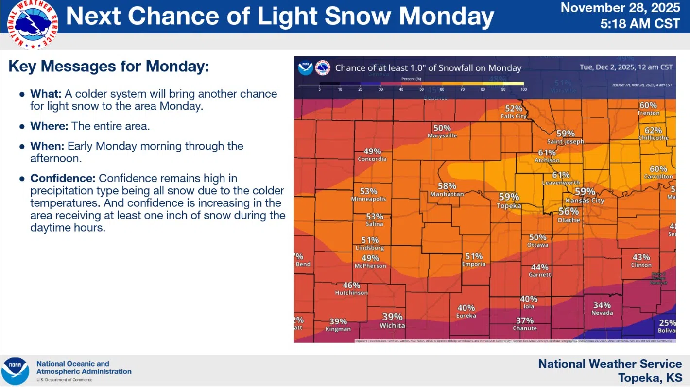
Monday currently has a decent chance of snowfall with highs in the mid- and upper 20s. Up to an inch of snow is currently possible.
KVOE and KVOE.com will have updates.


