


A small break in cold precipitation Sunday is expected to give way to the first potential snowfall of the year at the start of the work week.
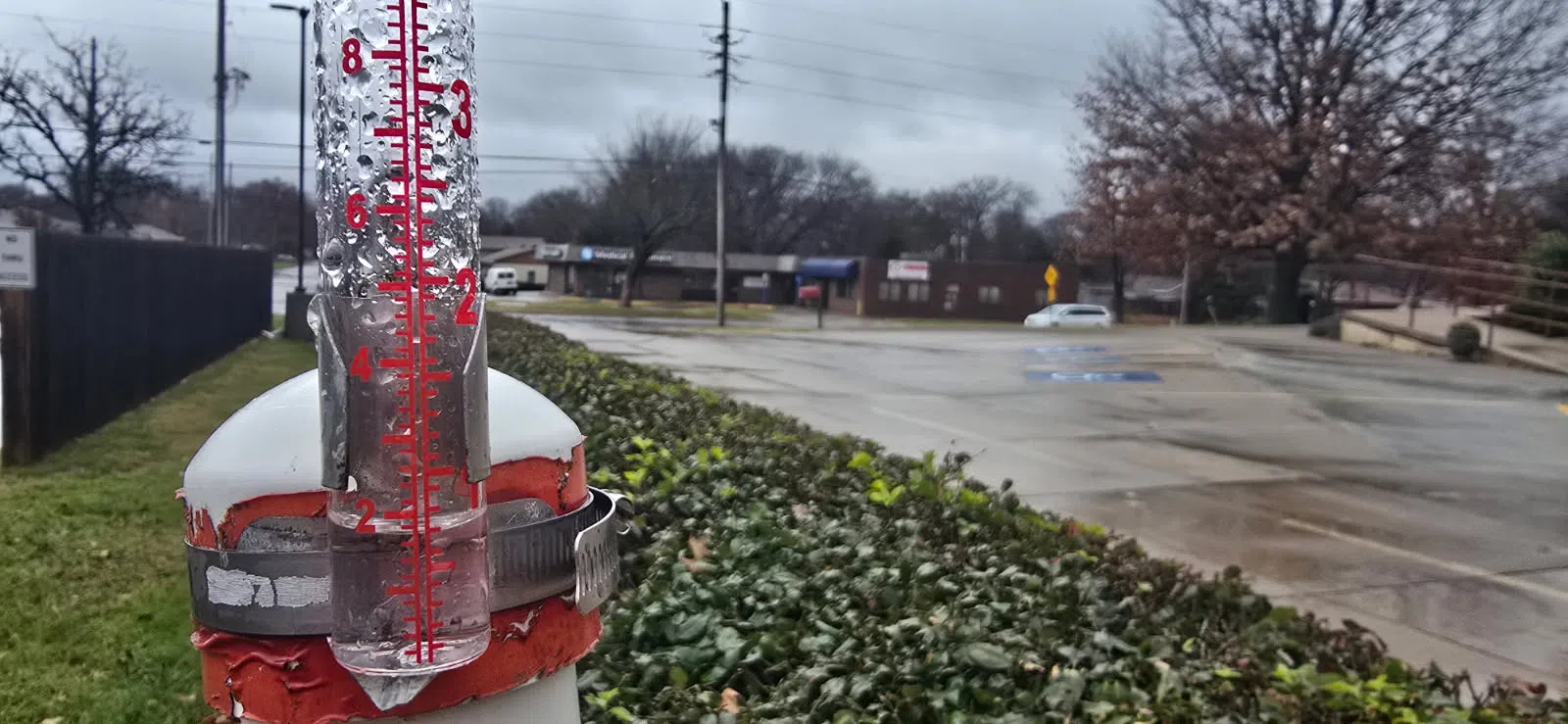
Moderate rain showers have been ongoing across the listening area since the early to mid-morning hours Saturday, bringing 0.80 inches to the KVOE Studios’ rain gauge.
Other totals:
10th and Weaver: 0.45 inches
Bushong: 0.59 inches
If you have rain totals to report, please message the KVOE Bluestem Farm and Ranch Supply textline 620-342-5863.
Saturday’s rainfall was accompanied by high temperatures in the low to mid-30s and are expected to drop to the low 20s overnight. A wind advisory remains in place for Lyon, Coffey and Morris counties until 6 pm Saturday before drier and calmer conditions arrive Sunday with mostly sunny skies and highs in the low 30s.
Monday has the first significant chance for wintry precipitation with a 50 percent chance of snow and temperatures below 30 degrees in the forecast. The remainder of the upcoming work week is expected to be mostly dry and sunny with high temperatures in the low 30s to mid-40s between Tuesday and Friday.
Stay with KVOE, KVOE.com and KVOE social media for more weather updates as they become available.


