


Lyon County’s road network is fully reopened with minor repair work underway following heavy rainfall from this past weekend.
That was the report from Lyon County Engineer Wayne Scritchfield Tuesday afternoon. According to Scritchfield, all barricades were removed from county roadways earlier in the day after rain showers between Friday and Saturday brought up to three inches of rain or more to the area in a near 24-hour period.
Scritchfield says the abundant rainfall did not leave any significant damage to the road network, with only a few ruts being the main concern. Scritchfield did say some roads lost a notable amount of gravel as well, but that, and the rut issues, were repaired by the end of business hours Tuesday.
The current forecast through the remainder of the week is calling for sunny and dry conditions through Friday afternoon. There is a slight chance for snowfall Friday night into Saturday, with high temperatures in the mid to low 40s and overnight lows ranging from the upper teens to low 20s.
Ahead of that, however, forecast conditions through Thursday will still be ripe for fire danger locally with winds between 15 and 20 mph throughout the day and some gusts as high as 30 mph at times. As such, outdoor burning is still highly discouraged for most of the area, if not outright banned.
Burn bans are still in effect for Coffey County and the unincorporated areas of Osage County, including Carbondale, until further notice. Fire weather watches had previously been issued for the entire listening area Monday; however, cloud cover and higher than originally expected humidity levels saw those canceled Tuesday morning.
Stay with KVOE, KVOE.com and KVOE social media for more weather updates as they become available.
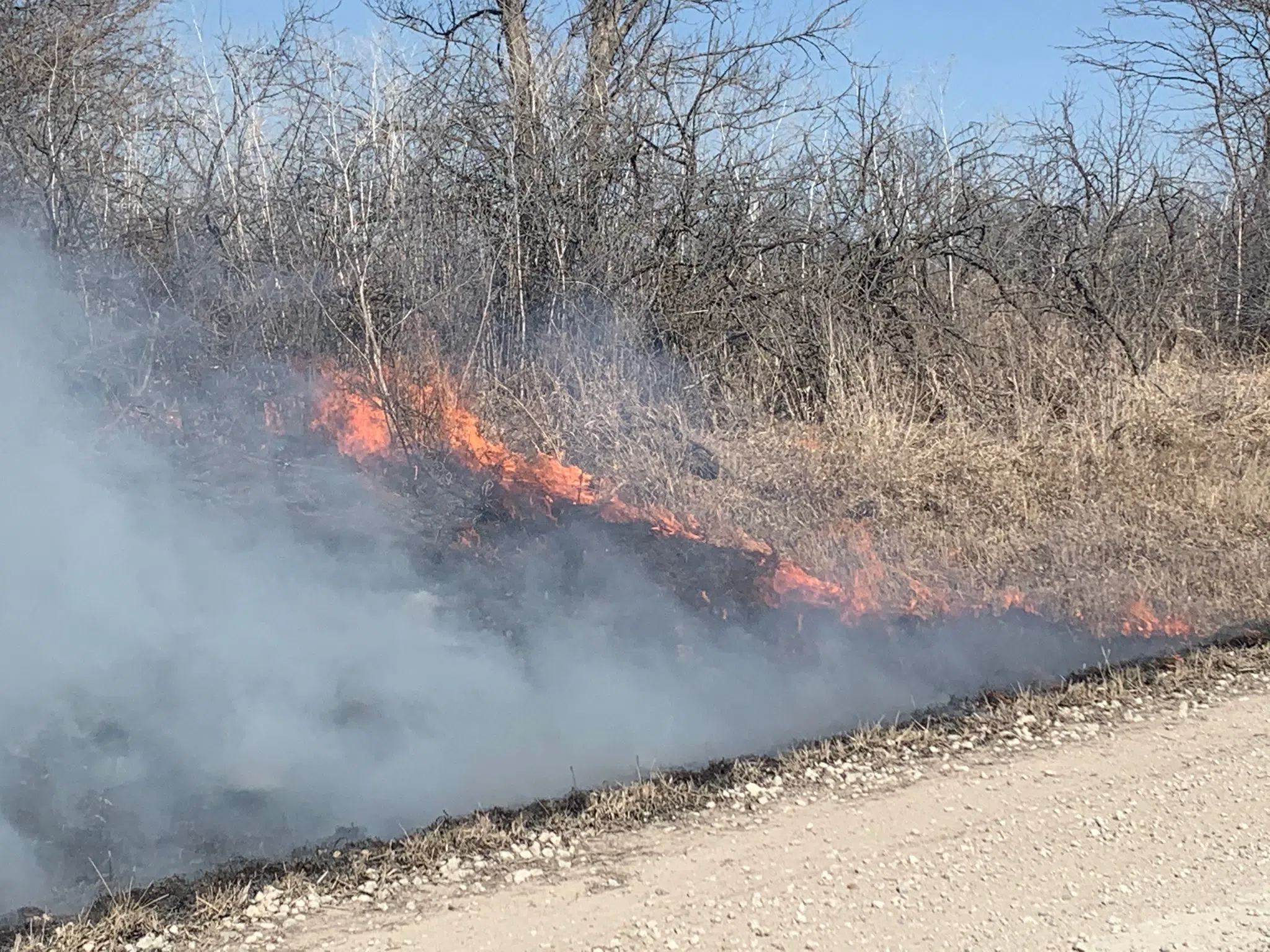
12:09 pm Tuesday: Fire danger very high Tuesday; semi/grass fire brings several fire departments to west Osage County
Outdoor burning is still discouraged areawide and it’s banned short-term in several area counties, but the critical fire danger expected earlier in the week hasn’t materialized.
The Weather Service has removed the fire weather watches affecting the eastern half of Kansas for Tuesday. Meteorologist Bill Gargan says high-level cloudiness signals higher relative humidity levels than those in Monday’s forecast models.
Relative humidity levels have been at or above 70 percent for most of Tuesday morning.
However, Gargan says it won’t take much for fires to expand rapidly if they form.
Several Lyon and Osage county fire departments responded to a combination vehicle-and-grass fire just after 9 am as a semi caught fire in far west Osage County. Burlingame Fire handled the grass fire, while Miller and Reading handled the truck fire. No injuries were reported. Peak wind speeds were already above 30 mph when the fire developed.
Meanwhile, the Lyon County Highway Department plans to work on several gravel roads Tuesday. The goal is to start reopening the roads damaged by up to 4 inches of rain Friday and Saturday and flooding that followed. The current list of closures:
*Road G between Roads 170 and US Highway 50
*Road 120 between Roads K and L
*Road 140 between Road J and Kansas Highway 99
*Road 150 between Road J and Kansas Highway 99
*Road 160, also known as Lockerman Road, between Roads G and J
*Road 210 between Roads K and L
*Road 240 between Roads D and F
*Road F between Roads 145 and 150
*Road J between Roads 140 and 150
*Road K between Roads 140 and 150
*1500 block Road 330
*1600 block Roads G and H
One of the area impacts from the weekend flooding is in Greenwood County, where the county landfill is closed Tuesday because muddy conditions have made the facility “inaccessible.” The current plan is to reopen the Greenwood County Landfill on Wednesday.
Regardless if water is visible over roadways or not, drivers are reminded that it is illegal to drive around or move barricades on roadways for any reason.
KVOE and KVOE.com will have updates. Click here for KVOE’s YouTube channel, including a fire danger status report.


