Saturday’s unseasonably mild conditions are setting up a brief return to winter, followed by a wet week.
After showers and embedded thundershowers early in the day, Saturday will see highs in the mid-70s with sunshine and occasionally breezes as high as 20 mph. Conditions will be similar to Friday. Initially, the forecast said relative humidity levels will be high enough to take the area out of the very high fire danger category, even with a wind shift from south to northwest after a cold front moves across the area Saturday afternoon — but now the National Weather Service says anybody south of Interstate 70 will deal with a very high fire danger through the afternoon.
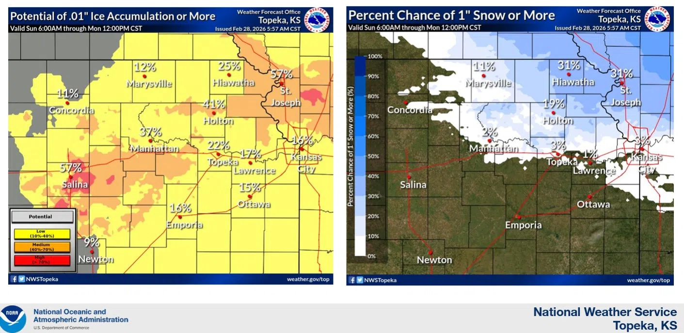
Once the front passes, cloud coverage will increase and temperatures will fall to just above freezing. More cold air moves across the area Sunday, causing chances of rain mixed with snow in the morning and sleet in the afternoon through early evening. Isolated icing is possible during the wintry mix and overnight as precipitation ends and temperatures dip just below freezing.
Rain chances continue all week, with thunderstorms possible Tuesday, Thursday night and Friday.
Stay with KVOE, KVOE.com and KVOE social media for updates.