


Severe weather season is upon us, and the National Weather Service wants you to be ready for all severe weather hazards over the next several months.
Severe Weather Awareness Week officially begins Monday. Weather Service Topeka Warning Coordination Meteorologist Chad Omitt says early March is not too early to start relaying the message that people need to be prepared.
As usual, the week ahead will have five different focal points, one per weekday:
*Monday: General preparedness. Omitt says the plan should be set, reviewed and practiced before it’s needed.
Also:
*Tuesday: Flood
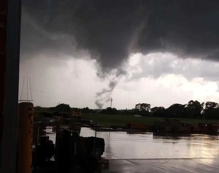
*Wednesday: Tornado
*Thursday: Hail and wind
*Friday: Lightning
Tornadoes get the most attention whenever severe weather is concerned, and with good reason.
Having said that, Omitt says flooding’s impacts on lives and property should never be understated.
Click here for the link to the Weather Service’s Severe Weather Awareness Week packet online. Click here and here for links to the Storm Prediction Center’s new Conditional Intensity Groups for tornadoes, wind and hail.
Also, the Weather Service is getting ready for its annual spotter training sessions. Areawide dates and locations include:
*Lyon County: March 26, 7 pm, Emporia State University Memorial Union Preston Family Room
*Chase County: March 11, 6:30 pm. Swope Park Community Center, Cottonwood Falls
*Coffey County: March 11, 7 pm. New Strawn Community Center
*Greenwood County: March 16, 6:30 pm. Eureka High School auditorium
*Morris County: March 9, 7 pm. Basement of the Morris County Courthouse, Council Grove
*Osage County: April 2, 7 pm. Lyndon Community Building
*Wabaunsee County: March 23, 7 pm. McFarland Senior Center
Whenever severe weather is in the forecast or underway areawide, trust KVOE and KVOE.com for the latest information. Our coverage will also involve the volunteer KVOE Storm Team spotter network, with on-location reports across Lyon and surrounding counties.


