


After a break, a risk of severe weather returns to parts or all of the KVOE listening area starting Thursday night.
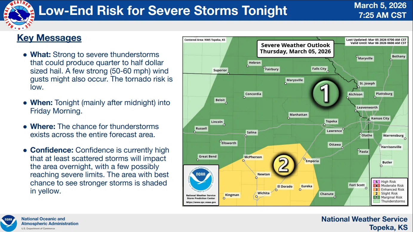
Currently, there is a marginal-to-slight severe weather risk areawide for Thursday night into the pre-sunrise hours Friday. Areas south and west of a line from Herington to Bushong to Neosho Rapids to near Toronto are in the slight risk area overnight.
National Weather Service meteorologist Sarah Teefey tells KVOE News the forecast resembles the one from early Wednesday, when strong storms moved out of Oklahoma and south-central Kansas towards our area well after dark.
Teefey says the area most likely to see severe weather is off to our south.
Early Friday also has the area’s first Conditional Intensity Groups for wind, essentially from Emporia to the south and west, and also for hail areawide. Both carry CIG Level 1 risks, meaning worst-case scenarios of wind gusts at least 74 mph and hail up to egg size. Teefey says it’s unlikely storms will reach those benchmarks across the KVOE listening area.
The period from mid-afternoon through the evening Friday now has an enhanced severe weather risk for all hazards areawide.
Teefey says there is at least one item that could limit severe weather Friday.
CIG Level 1 risks are up for all hazards, which would also include EF0-EF2 tornadoes.
Be sure to stay with KVOE and KVOE.com for updates. Also, if you have not joined KVOE’s social media platforms, find us on Facebook, Instagram and YouTube — all @kvoenews — and on X@kvoeam1400.


