Critical fire danger is expected to extend into the weekend.
While a red flag warning continues for Lyon and several surrounding counties until 9 pm Friday, almost all area counties are now in red flag warnings for Saturday. Lyon, Chase, Coffey, Morris, Osage and Wabaunsee counties are in red flag warnings from 11 am to 10 pm.
Saturday will mark the third straight day for red flag warnings and resulting automatic burn bans for affected area counties. Relative humidity levels under 20 percent, wind gusts between 30-40 mph and dry grasses are constant for the rest of Friday and Saturday. Similar temperatures are likely, although there will be a wind shift from out of the north Friday to a southerly direction Saturday.
Several area counties under red flag warnings have also announced county-specific burn bans. Chase County is in a ban until at least Wednesday. Osage County is in a county-announced ban Friday.
KVOE and KVOE.com will have updates.
9 am Friday: Critical fire danger ongoing with red flag warnings Friday, fire weather watches Saturday
Significant fire danger continues areawide through the upcoming weekend despite rainfall Thursday night and early Friday.
Red flag warnings, announced Thursday, will be active for Lyon, Coffey, Morris, Osage and Wabaunsee counties from 12-9 pm Friday after red flag warnings covered most area counties Thursday. Temperatures will be sharply cooler Friday than they were Thursday, with highs approaching 60 instead of the record high of 95 experienced Thursday. Winds will also be out of the north instead of the south, but gusts will still be 30-40 mph and relative humidity levels will be as low as 15 percent.
Besides highlighting the general fire danger and risk of extreme fire behavior, red flag warnings signal automatic burn bans for affected counties.
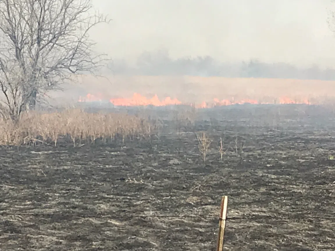
Weather conditions were much more conducive to controlled burns early in the week, and there were a lot of fires areawide. Lyon County Emergency Management Director Jarrod Fell says there is “always” a concern about rekindles, even several days after initial fire activity.
Peak burn season is underway through April, and there haven’t been a lot of good days to burn this season because of windy conditions. After nearly three weeks straight of little to no moisture, the forecast gets damp with a lot of rain chances Monday night through Thursday. Fell says the grass fire season is starting to get “compressed.”
Fire weather watches then cover the area from 11 am to 10 pm Saturday, meaning critical fire danger is possible to likely. The National Weather Service also says Monday and Tuesday could also see some sort of fire alert due to warm, breezy conditions despite slight chances of rainfall.
Fire activity Thursday saw several Greenwood County departments helping nearby counties with large grass fires, first with Elk County for a fire starting near Kansas Highway 99 and Rock Road shortly before 4 pm before a fire along the Greenwood-Wilson county line Thursday night.
Rain totals from Thursday night:
*KVOE studios: 0.10 inches
*Emporia Municipal Airport: 0.16 inches
*10th and Weaver: 0.05 inches
*Between Hartford and Olpe: 0.20 inches
*Kansas Highway 99 at Lyon-Greenwood county line: 0.20 inches
KVOE and KVOE.com will have updates.