



Showers and storms are possible to likely by Wednesday evening. Severe weather is also possible.
Pockets of showers and storms are possible through the day, but TV-13 meteorologist Doug Meyers says more widespread rainfall starts covering the area after sunset.
Two area counties, Morris and Wabaunsee, are in a flood watch until 6 pm Thursday. Two area counties, Morris and Wabaunsee, are in a flood watch until 6 pm Thursday.
Meyers is also watching a low-level severe weather risk for area counties from late afternoon through mid-evening. There is now a slight overall risk along and west of a line from Carbondale to Reading to Olpe to Matfield Green, including a chance of a brief tornado. Areas east of that line are in a marginal risk for severe activity. Wind gusts up to 60 mph is the most likely hazard areawide.
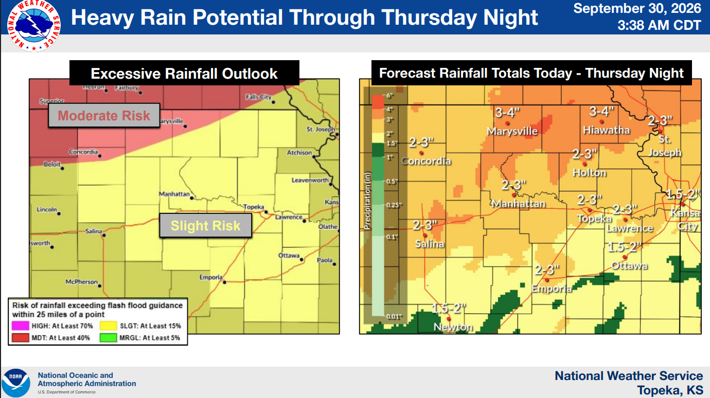
Additional rainfall is likely Thursday, and Meyers says heavy rain is possible through the day into the evening hours. The Weather Service is calling for 2-3 inches of rain as standard through Thursday night, with 4-inch totals increasingly possible to our north. The Weather Service Forecast Points information page is calling for anywhere from 1-1.5 inches of rain just on Thursday.
Rain totals through 9 am include:
*KVOE studios: 0.30 inches
*Emporia Municipal Airport: 0.20 inches
*1100 block Constitution: 0.25 inches
*10th and Weaver: 0.30 inches
*South and Sylvan: 0.25 inches
*7 miles southwest of Emporia: 0.40 inches
*1 mile north of Allen: 0.25 inches
*Eureka Milliken Airport: 0.22 inches
*Neosho Rapids: 0.20 inches
*2 miles north of Olpe: 0.20 inches
*2.5 miles northeast of Reading: 0.34 inches
KVOE, KVOE.com, TV-13 and Weatherology will keep you posted through the day. If you have rain totals, message the KVOE Bluestem Farm and Ranch Supply text line at 620-342-5863.
















