



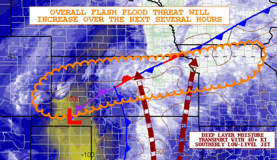
Most area counties are now under one of 2 flood watches as announced by the National Weather Service.
Morris and Wabaunsee counties remain in a flood watch until 6 pm Thursday. Meanwhile, Lyon, Coffey and Osage counties are part of a watch announced Thursday morning and extending to 4 am Friday. The Weather Service says rain totals have been between 1-4 inches since Tuesday, with another 0.5 to 1.5 inches of rain possible before rain ends Thursday night.
The potential for heavy rain and storm activity is leading to schedule adjustments for area athletics.
*Emporia High boys varsity soccer, JV girls golf at Junction City, cross country meet at Council Grove (also including Burlington, Lebo, Lyndon, Madison-Virgil, Northern Heights and Waverly) and JV girls tennis at Salina have all been canceled
*Lyndon’s JV football game against Northern Heights on Monday has been canceled due to injuries and anticipated field conditions
Stay with KVOE, KVOE.com and KVOE social media for updates.
9:05 am Thursday: Light to moderate rainfall areawide
No severe weather developed areawide Wednesday afternoon or evening — and not much rainfall happened in Emporia, although other locations got substantially more rain.
Showers and storms moved across the area starting by mid-afternoon, but they were unable to take advantage of abundant moisture and increasing low-level shear — unlike north-central Kansas, where there were reports of tornadic activity across parts of Barton, Lincoln, Mitchell, Pawnee and Russell counties. Areas near Susank had reported damage to outbuildings. No injuries have been reported.
As far as rainfall goes, the KVOE studios had 0.30 inches between Tuesday afternoon and 4 pm Wednesday, followed by another 0.20 inches up to 3 am Thursday. Other totals from Tuesday to Thursday:
*Emporia Municipal Airport: 0.27 inches
*1100 block Constitution: 0.15 inches
*South and Sylvan: 0.20 inches Thursday
*10th and Weaver: 0.15 inches Wednesday into Thursday
*1 mile north of Allen: 0.90 inches Wednesday into Thursday
*Cottonwood Falls: 1.10 inches
*Eureka Milliken Airport: 1.08 inches
*Kansas Highway 99 at Lyon-Greenwood county line: 0.75 inches
*Lamont: 1.40 inches
*Lebo Heidi Inn: 1.25 inches
*500 block Lyon County Road 290: 1.50 inches
*Neosho Rapids: 1 inch
*Olpe Blacksmith Shop: 0.40 inches Wednesday evening into Thursday
*2.5 miles northeast of Reading: 0.28 inches
More rainfall is likely through Thursday as a storm system pumps moisture north through Texas and Oklahoma. A flood watch is still in effect for Morris and Wabaunsee counties until 6 pm. The National Weather Service Forecast Points information page indicates an inch or more of rainfall is possible into early Friday. After that, the forecast calls for dry and mild conditions, starting with sunshine and highs in the mid-60s Friday and continuing with highs in the 70s for the weekend through at least Tuesday. Showers are set to re-enter the picture Tuesday night.
If you have rain totals, message the KVOE Bluestem Farm and Ranch Supply text line at 620-342-5863.
















