



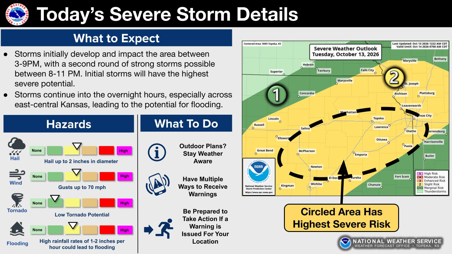
A severe thunderstorm watch is now in place for the entire KVOE listening area through late Tuesday.
The watch, affecting Lyon and all surrounding counties, will remain in place through 11 pm Tuesday, with a slight severe weather risk also covering the area through the early to late evening hours. The main hazards will be hail up to two inches in diameter, wind gusts between 60 and 70 mph and heavy rainfall that could lead to flooding, with 1-2 inches possible between rounds of storms, with the best likelihood for activity coming between now and 9 pm.
A flood watch also remains in place at this time from now until 10 am Wednesday, with the possibility of an extension through Thursday morning. KVOE and Weatherology will keep you updated throughout the evening hours.
6:39 am Tuesday: High temperatures narrowly missed setting a daily record Monday. We could set a daily record Tuesday before strong thunderstorms and sharply cooler conditions come to the area.
High temperatures reached 89 degrees, according to the National Weather Service, just below the 91-degree record set 2 years ago. The Weather Service says Emporia’s daily record for Oct. 13 is 87 set in 1962, and the current forecast for Tuesday has a high of 94.
By late Tuesday afternoon, Weather Service meteorologist Matt Flanagan says strong storms could form along a cold front.
Once the severe threat ends by mid-evening, the rain may continue.
All area counties are in a flood watch from 5 pm Tuesday through 10 am Wednesday, and the Weather Service says it may have to extend the watch to Thursday. KVOE, KVOE.com and Weatherology will have updates.
















