


Both flood warnings for two local rivers have come to an end a bit sooner than originally anticipated.
The Cottonwood River in Emporia dropped well below the flood stage of 20 feet to 16.94 feet around 1:30 pm Saturday. Following this, the Neosho River at Neosho Rapids fell below the 22-foot flood stage and as of 4:30 pm sits around 21.89 feet.
The Neosho River flood warning was anticipated to last until Sunday morning. While the river levels have dropped for now, there are still chances of showers and thunderstorms in the forecast Sunday through midweek.
Stay with KVOE and KVOE.com for flood updates. Make sure to follow us on Twitter@kvoeam1400 or Facebook@kvoenews for instant alerts.
1:30 pm Saturday: UPDATE: Flood warning for Cottonwood at Emporia officially over, Neosho at Neosho Rapids remains through Sunday
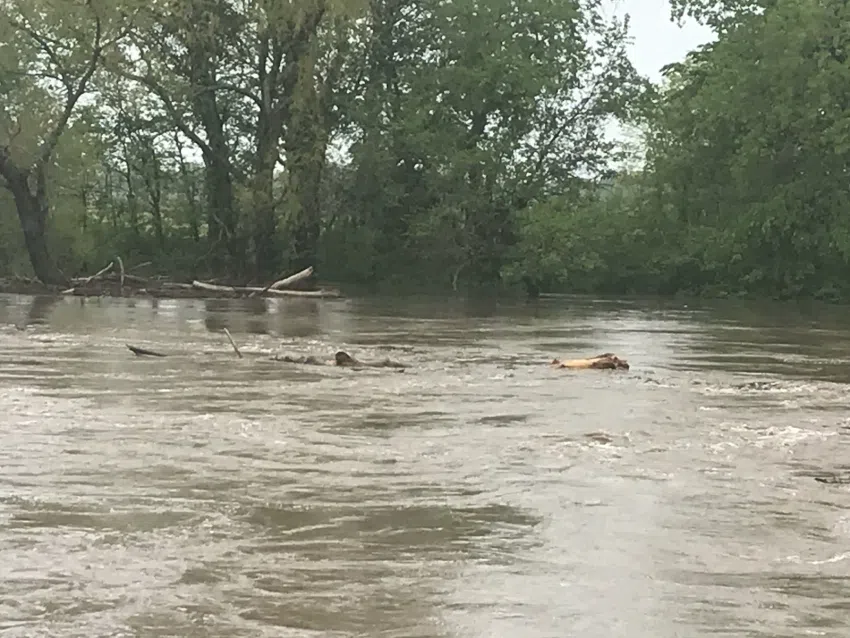
One of two rivers placed in a flood warning earlier this week has finally fallen well below flood stage as another continues on a steady decrease Saturday.
The warning for the Cottonwood River in Emporia has come to an end as the river fell well below the flood stage of 20 feet early Sunday morning. As of 1:30 pm the river was sitting at 16.94 feet and is anticipated to continue decreasing throughout the day Saturday.
The flood warning for the Neosho at Neosho Rapids remains in effect through Sunday morning. The river held steady in the moderate flood range throughout Friday reaching a high just over 24 feet. As of 1:30 pm the river is sitting at 22.56 feet just narrowly above the flood stage of 22 feet. Current projections indicate the river should drop below flood stage by sometime Saturday afternoon.
Weather conditions are expected to be mostly dry throughout the day Saturday before chances of showers and thunderstorms re-enter the forecast Sunday potentially lasting into mid-week.
Stay with KVOE and KVOE.com for flood updates. Make sure to follow us on Twitter@kvoeam1400 or Facebook@kvoenews for instant alerts.
7:30 am Saturday: Update river levels dropping closer to below flood stage
With one local flood warning set to expire later Saturday, another may not be far behind it as river levels continue to drop at a steady pace.
Two river gauges remain in flood warnings Saturday morning. Those warnings include:
*The Cottonwood at Emporia until Saturday evening. The river reached a high of 23.9 feet Friday and held steady above 23 feet throughout the day before dropping to 21.36 by early Saturday morning. Current projections place the river at 20.64 feet, just narrowly above the flood stage of 20 feet. Current models show the river dropping below the flood stage by Saturday afternoon.
*The Neosho at Neosho Rapids until Sunday morning. Current projections show the river at 23.33 feet above the flood stage of 22 feet. Models project the river sliding below the flood stage by early Saturday afternoon.
Multiple roads and intersections remain closed due to the heavy rainfall throughout the week. The current list includes:
*Road 145 east of F
*Road 145 west of the Neosho Rapids river bridge
*Road 150 from C to F; Kansas Highway 99 west to J and east to M; from N to R; west of the Neosho Rapids river bridge
*Road 155 west of Kansas Highway 99 and south of Road W
*Road 160 from G-5 to H; from R to S
*Road 167 from R
*Road 190 from K to L
*Road A from 170 to 180
*Road C north of 150
*Road D north of 150
*Road E north of 150
*Road G north of 140 and south of 160; from 160 to 170
*Road H north of 140; from 160 to 165
*Road J (Prairie Street) south of 160; from West 30th (Road 190) to Road 215
*Road K north of 140
*Road M from 140 to 150
*Road P north of 140 and north of 150
*Road R from 150 to 160
*Road S north of 130
*Road T north of 130
*Road V north of 120
*Road W north of 110
Weather conditions are expected to be mostly dry throughout the day Saturday before chances of showers and thunderstorms re-enter the forecast Sunday potentially lasting into mid-week.
Stay with KVOE and KVOE.com for flood updates. Make sure to follow us on Twitter@kvoeam1400 or Facebook@kvoenews for instant alerts.
6 am Saturday: River levels on steady decrease as local flood warnings remain in effect.
Minor to moderate flooding continues at local river bodies following heavy rainfall throughout the week.
Two river gauges are still in flood warnings, with one set to expire later Saturday evening. The warnings include:
*The Cottonwood at Emporia until Saturday evening. According to the latest projections, the river is currently sitting at 21.36 feet above flood stage of 20 feet after holding steady just above 23 feet throughout the day Friday. Current models show the river dropping below flood stage by early Saturday afternoon.
*The Neosho at Neosho Rapids until Sunday morning. Current models place the river at 23.51 feet above the flood stage of 22 feet. Projections show the river should slide below the flood stage by early Saturday afternoon.
Several county roads and intersections remain closed due to the high waters. They include:
*Road 145 east of F
*Road 145 west of the Neosho Rapids river bridge
*Road 150 from C to F; Kansas Highway 99 west to J and east to M; from N to R; west of the Neosho Rapids river bridge
*Road 155 west of Kansas Highway 99 and south of Road W
*Road 160 from G-5 to H; from R to S
*Road 167 from R
*Road 190 from K to L
*Road A from 170 to 180
*Road C north of 150
*Road D north of 150
*Road E north of 150
*Road G north of 140 and south of 160; from 160 to 170
*Road H north of 140; from 160 to 165
*Road J (Prairie Street) south of 160; from West 30th (Road 190) to Road 215
*Road K north of 140
*Road M from 140 to 150
*Road P north of 140 and north of 150
*Road R from 150 to 160
*Road S north of 130
*Road T north of 130
*Road V north of 120
*Road W north of 110
Weather conditions are expected to be mostly dry throughout the day Saturday before chances of showers and thunderstorms re-enter the forecast Sunday potentially lasting into mid-week.
Stay with KVOE and KVOE.com for flood updates. Make sure to follow us on Twitter@kvoeam1400 or Facebook@kvoenews for instant alerts.
 (1)")


")