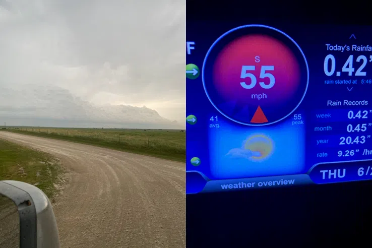
Strong to severe thunderstorms are possible across the KVOE listening area Thursday night and again Friday.
Thunderstorms are expected across the area by mid-evening Thursday, and some could be strong to severe with hail and high winds the main threats. Isolated tornadoes can’t be ruled out but are unlikely. Friday could have thunderstorms beginning by early afternoon and continuing past sunset. Again, hail and high winds are the main concerns. Isolated tornadoes are possible but unlikely.
Storms Thursday morning were not officially severe, but thundershowers generated estimated winds of 50-70 mph along the US Highway 56 corridor. Winds were estimated above 70 mph just north of Allen and around 55 mph outside Bushong. There have been several small power outages stretching from Council Grove east to Osage City and south to Reading.
While severe weather is not guaranteed the next two days, heat and humidity are a given until conditions improve Saturday. Thursday’s air temperatures will get to 98 degrees in Emporia with heat index readings as high as 104-106. Friday’s air temperatures could reach 96 with heat index readings above 100.
6 am Thursday: Heat, humidity, possible severe weather predicted for Thursday and Friday
Hot and steamy conditions could lead to stronger storm activity the next two days, and there is a low-end severe weather risk for Saturday as well.
High temperatures could approach 100 degrees Thursday with an expected high of 98 and heat index readings as high as 106 for Emporia. Thunderstorms are expected across the area by mid-evening, and some could be strong to severe with hail and high winds the main threats. Isolated tornadoes can’t be ruled out but are unlikely.
It’s a similar story on Friday. High temperatures could reach 96 with strong to severe storms possible by early afternoon. Again, hail and high winds are the main concerns. Isolated tornadoes are possible but unlikely.
Right now, a slight severe weather risk covers the area for Thursday, with a marginal risk Friday and another marginal risk areawide for Saturday with storms possible by Saturday evening.
With the multiple severe weather risks in place through Saturday, stay with KVOE, KVOE.com and KVOE social media for updates. Also, be sure to join KVOE on Facebook@kvoenews and Twitter@kvoeam1400 for instant severe weather alerts if you haven’t already signed up. We also encourage you to download KVOE’s free mobile app so you have our severe weather coverage wherever you may be.


