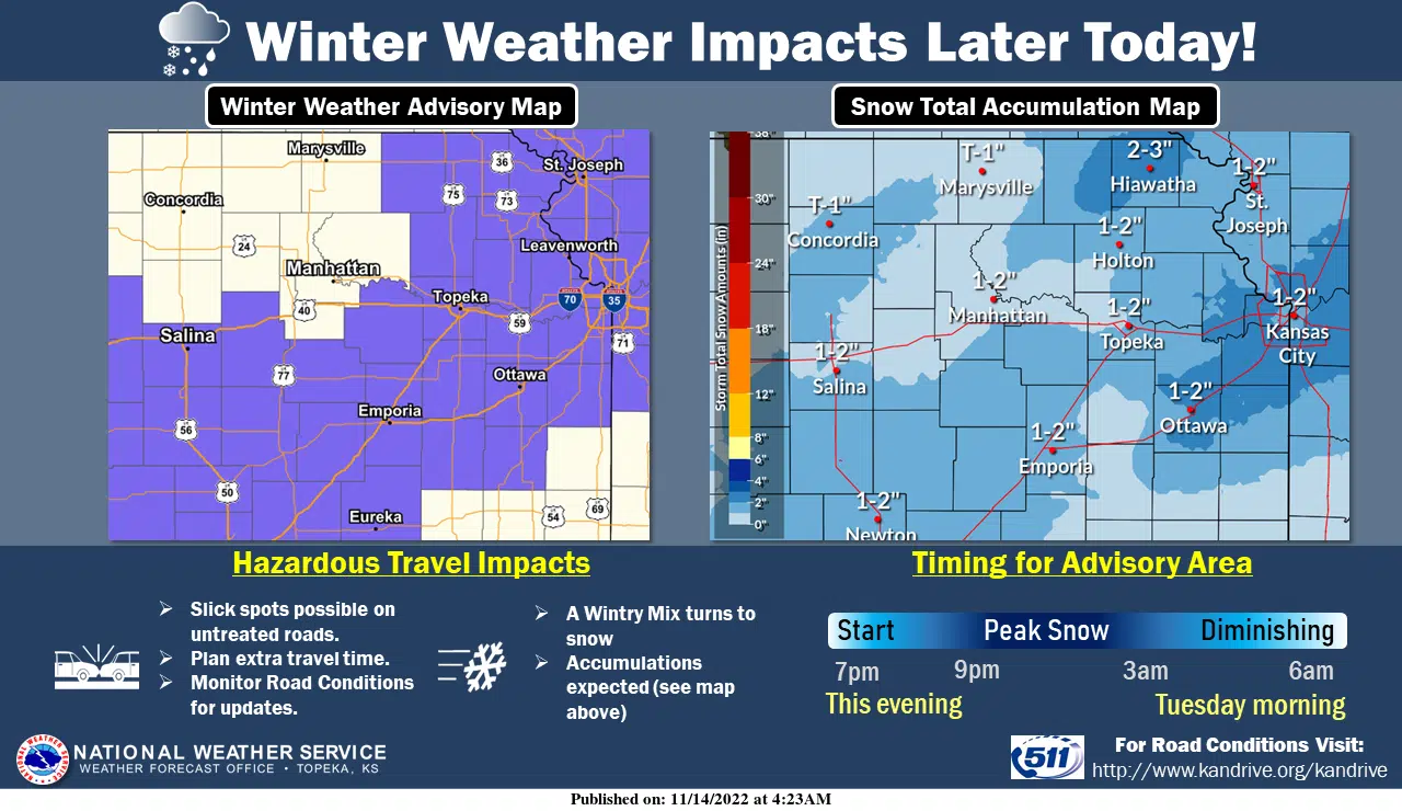
Accumulation projections have not changed, however, the timeline for the listening area’s first accumulating snowfall, and a pair of area advisories have been slightly adjusted.
TV-13 meteorologist Jeremy Goodwin says rainfall is expected to begin in the early evening hours around 5:30 pm and should begin to change over to a mixture of snow and rain, eventually becoming all snow, between 8 pm and 9 pm Monday evening.
Projections are still calling for accumulations between an inch to two inches between Monday night and Tuesday morning. Winter weather advisories remain in place for all area counties with most counties — Lyon County included — are affected from 7 pm Monday to 6 am Tuesday. Chase County’s advisory has been extended and now goes until 3 am Tuesday as does Greenwood County’s which goes into effect at 6 pm Monday night.
Temperatures behind the system will be in the 30s through Thursday and in the 20s Friday. This appears to be our only chance of precipitation for at least the next week.
We’ll keep you updated on KVOE, KVOE.com and KVOE social media.
8:57 am Monday
Expect light snowfall across the KVOE listening area beginning Monday evening.
A gradual changeover from rain to snow is in the forecast Monday evening, meaning some slick conditions for the late-night hours Monday and early-morning hours Tuesday. Here’s TV-13 meteorologist Doug Meyers:
The National Weather Service has issued winter weather advisories for all area counties with up to two inches of snowfall expected. Most counties — Lyon County included — are affected from 7 pm Monday to 6 am Tuesday. Chase County’s advisory goes from noon-10 pm Monday, while Greenwood County’s advisory goes from 6-10 pm Monday.
This appears to be our only chance of precipitation for at least the next week. High temperatures ahead of the incoming system will peak in the low 40s. Temperatures behind the system will be in the 30s through Thursday and in the 20s Friday.
We’ll keep you updated on KVOE, KVOE.com and KVOE social media.


