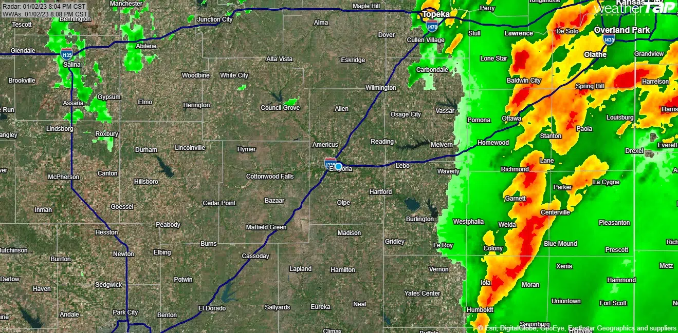
The first potential severe weather episode of 2023 ended with no severe weather and, for many area residents, not much in the way of rainfall.
Monday’s severe weather risk increased from marginal to slight between the Storm Prediction Center’s midnight and 8 am model runs, and it stayed slight through mid-evening, leading to a tornado watch for Greenwood County. Storms materialized as expected around 3 pm, but they never led to any warnings or confirmed reports for area counties — although small hail was reported east of Burlington.
Rain totals have been both isolated and minimal.
*KVOE studios: 0.02 inches
*Emporia Municipal Airport: 0.01 inches
*2 miles east of Emporia Municipal Airport: 0.47 inches
*Eureka Miliken Airport: 0.02 inches
If you have rain totals, call KVOE at 620-342-1400. Text your rain totals or storm photos to the KVOE Bluestem Farm and Ranch text line at 620-342-5863.
3:45 pm Monday: Greenwood County in tornado watch until 10 pm
The National Weather Service has issued a tornado watch for one area county.
Greenwood County is in a watch now until 10 pm Monday evening. The watch comes as a slight severe weather risk remains in place for the entire KVOE listening area.
Aside from the possibility of isolated tornados, additional concerns are for wind gusts as high as 60 mph and hail up to the size of quarters. A dense fog advisory remains in place for Lyon, Coffey, Chase, Osage and Greenwood counties until 6 pm.
11:30 am Monday: Slight severe weather risk now in place areawide beginning late Monday afternoon
The second day of January has already seen thick fog across most of the KVOE listening area. The rest of the day features a chance of severe spring weather.
The late-morning update from the Storm Prediction Center involves a slight overall severe weather risk. Here’s TV-13 meteorologist Doug Meyers:
The National Weather Service expects storms to develop in central Kansas by mid-afternoon and move into the KVOE listening area by late afternoon. Storms should clear area counties by mid-evening.
Along with the severe weather risk comes a chance of rainfall, but totals will likely be half an inch or less — and in some cases may be under 0.10 inches. The current forecast indicates this is the only chance of rainfall for the week.
The storm chances follow pockets of dense fog across the KVOE listening area that formed before 8 am and lasted past 11 am.
6:30 am Monday: Severe spring storms possible Tuesday
It’s the second day of January, but there’s a chance we may be dealing with severe spring weather by the end of the day.
The Storm Prediction Center has all area counties in a marginal severe weather risk, meaning the lowest on its 5-point scale. The main concern is hail up to the size of quarters. Rain is likely for the afternoon and evening hours, with thunderstorm chances developing by mid-afternoon and increasing through the mid-evening hours.
The current forecast indicates this is the only chance of rainfall for the week.
Stay with KVOE, KVOE.com and KVOE social media for updates. The KVOE Storm Team volunteer spotter network is being notified and will be available to provide reports if the situation warrants. If you have rainfall or storm reports, call KVOE at 620-342-1400 or message reports — and photos — to the KVOE Bluestem Farm and Ranch text line at 620-342-5863.


