


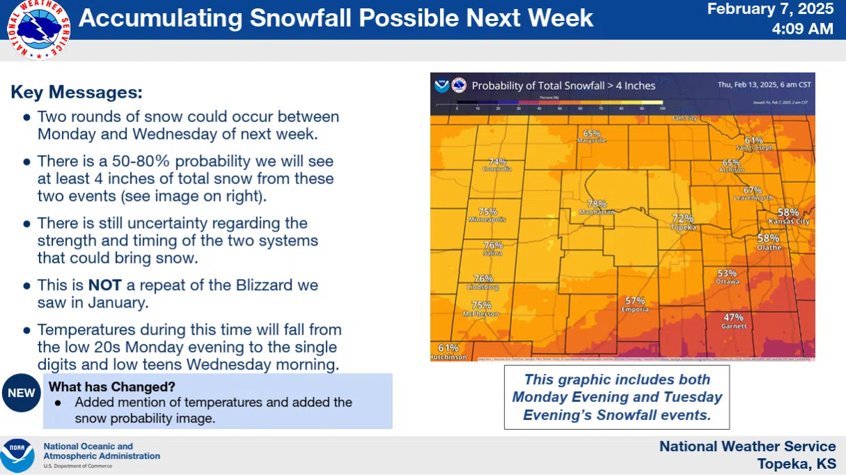
Projections will likely change over the next several days, but area residents can expect some accumulating snowfall next week, based on the current forecast.
The National Weather Service says areas south of Interstate 35 and US Highway 50 have a good chance — currently 50 to 80 percent — of receiving at least 4 inches of total snowfall as part of two separate snowstorms, one coming to the area late Monday night through Tuesday morning and another Tuesday evening through Wednesday. Projections for the Feb. 14-16 time period are pending.
Unlike the area’s biggest snowfall of the season to date last month, when up to half an inch of ice and 5-plus inches were followed by subzero temperatures and wind chills Jan. 4-5, high temperatures should be in the 20s and lows should stay above zero for most of next week.
KVOE and KVOE.com will have updates.


