


It’s not taking long for the weather forecast to leave winter behind — at least for now.
After a combination of light snowfall and high wind Tuesday night into Wednesday, high temperatures will at least be in the 50s through Saturday before highs climb to the 70s for much of next week.
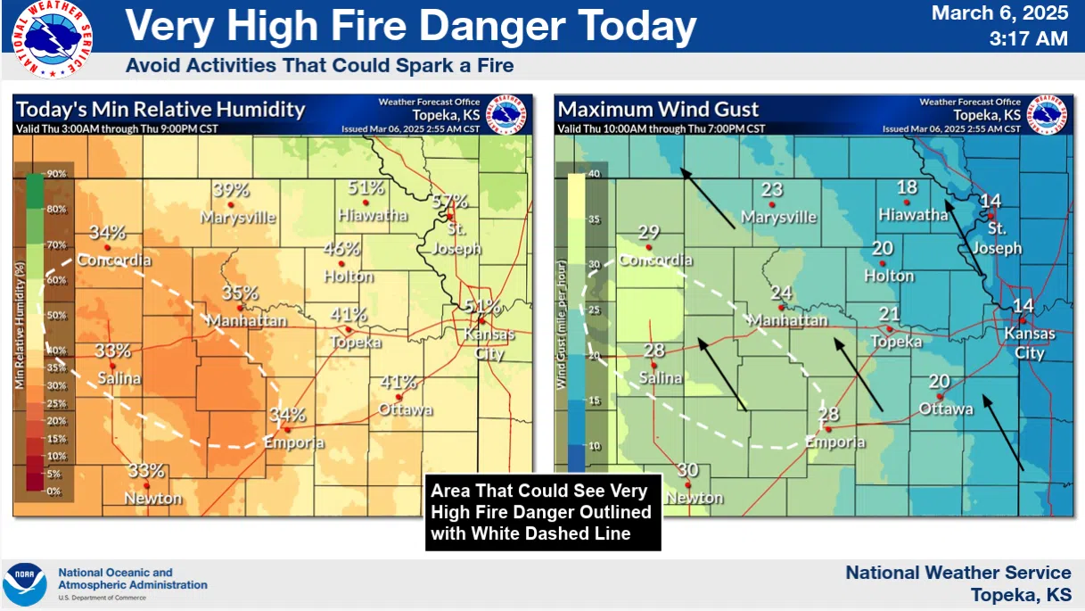
Along with that, at least through Friday night, will be an elevated fire danger. In fact, the National Weather Service has outlined a very high fire danger Thursday for areas from just west of Emporia northwest to places like Concordia and Salina. Wind gusts as high as 30 mph, drying grasses and low humidity levels will contribute to the fire danger. Outdoor burning is not recommended Thursday or Friday with almost identical conditions in the forecast.
KVOE and KVOE.com will have updates.


