


Heavy rain in central Lyon County from late Thursday afternoon and early evening have closed a short list of roads.
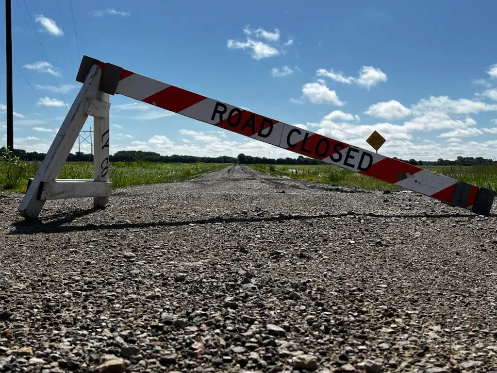
The Lyon County Highway Department has placed barricades at these locations:
*Road 150 from Kansas Highway 99 to Road J
*Road J between Roads 140 and 150
*Road K between Roads 140 and 150
Residents are urged not to drive around the barricades.
The 1300 block of Kansas Highway 99 had water running over it Thursday evening, while the Mechanic Street underpass was closed due to flooding. Those areas have since cleared.
Emporia had up to 2 inches of rainfall after a slow-moving storm crossed Lyon County. Overall, rain totals from Thursday ranged from 0.20 inches near Neosho Rapids to over 3 inches three miles east of the Emporia Municipal Airport.
More showers and storms are possible all the way through Thursday. KVOE and KVOE.com will keep you updated.
7:45 pm Thursday to 8:45 am Friday: Brief heavy rain leads to flash flood warning for Emporia, west central Lyon County
On Wednesday night, heavy rain caused flash flooding in parts of Osage County. More flash flooding came to Emporia and Lyon County as part of heavy thunderstorms Thursday.
An isolated, slow-moving storm dumped up to two inches of rainfall in Emporia, leading to water going over the road in the 1300 block of Kansas Highway 99, as well as the closure of the Mechanic Street underpass and scattered street ponding across Emporia. Those areas have since cleared. There was also a reported water rescue as a vehicle got stuck in the Emporia West Plaza parking lot. The vehicle in question was moved to a safe area with no reported injuries.
Nearby river gauges rose quickly but are nowhere close to flood levels.
Rain totals:
*KVOE studios: 1.45 inches
*Emporia Municipal airport: 1.62 inches
*Ninth and Burns: 2 inches
*10th and Weaver: 0.80 inches
*1100 block Constitution: 1.25 inches
*12th and Sunnyslope: 1.50 inches
*Bluestem Hall: 2 inches
*Country Club Heights: 0.82 inches
*Deerbrook Addition: 1.80 inches
*Meadowlark Lane: 2 inches
*3 miles south of Emporia: 3.12 inches
*2100 block J-7: 2.10 inches
*4 miles east of Cottonwood Falls: 0.20 inches
*Neosho Rapids: 0.20 inches
*Between Hartford and Olpe: 0.90 inches
*Olpe blacksmith shop: 1.30 inches
*1 mile east of Olpe: 1.25 inches
*Thorndale: 0.40 inches
*Toledo: 0.45 inches
Wednesday night’s storms dumped almost 2.5 inches of rain near Osage City, leading to a temporary closure of Kansas Highway 31 near the Osage City Airport. There was also hail up to 1.25 inches in diameter.
Rain chances will drop from likely to unlikely from Thursday night through Friday and will briefly disappear Friday night before returning with a slight chance of showers Saturday afternoon. Chances quickly increase as thunderstorms return to the forecast picture early Sunday. Rain chances are also present for most of next week.
If you have rain totals or storm reports, message the Bluestem Farm and Ranch text line at 620-342-5863.
 (1)")


")