


While river levels are dropping, the length of one flood warning is extending.
The National Weather Service has extended a flood warning for the Neosho River at Neosho Rapids until late Monday morning. The warning was previously set to expire Sunday.
The river was last observed at 25.1 feet above the 20 foot flood stage. The river is expected to drop below flood stage by Sunday afternoon.
Meanwhile, a flood warning continues until late this evening for the Cottonwood River at Plymouth.
Stay tuned to KVOE, KVOE.com and KVOE social media for more updates on the flooding situation as it continues to develop.
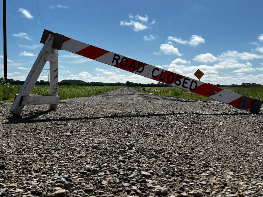
10:02 am: River levels are dropping, but patience urged as area road network eventually dries out; marginal severe weather risk ahead
Thankfully, river levels are decreasing — but river-based flooding persists along the Cottonwood and Neosho rivers after our latest burst of heavy rainfall earlier this week.
Also elevated: the number of water rescues for the KVOE listening area.
Chase County has now recorded four water rescues since Wednesday afternoon following an incident at 210 Road and U Road east of Cottonwood Falls on Thursday. A bread truck tried to pass through several hundred feet of standing water but was carried downstream by the current. The driver escaped and, according to the Sheriff’s Office Facebook page, floated with the current to a power pole, where that person stayed until retrieved by rescue crews. The driver was checked on scene for possible hypothermia, declined a hospital transport and was cited for disobeying a traffic control device.
Lyon County has had two water rescues so far this week, one Wednesday on Road C near US Highway 50 and one Tuesday near Roads 140 and H. With flooding possibly ending this weekend and a lot of road repairs to follow, Lyon County Deputy Dylan Jacobs urges drivers to be patient.
Greenwood County has also had a handful of water rescues this week after 3-7 inches of rain Tuesday.
How another 0.25-1 inch or more of rainfall areawide through noon Friday affects area rivers in the short term is yet to be seen. Click here for the latest flood warning information.
As far as current driving conditions, Kansas Highway 99 remains closed between Emporia’s southern city limits and Road 130 with floodwater still on the highway just south of Soden’s Grove. The current indications are the closure may be removed early Saturday. With concerns about toll costs as the Kansas Turnpike Authority has opened its floodgates at mile marker 122 for the first time since cashless tolling went into effect last year, the Turnpike Authority is urging drivers to call its DriveKS customer service center at 800-873-5824 with questions about or assistance with flood-related toll charges.
Also, Kansas Highway 177 reopened between Cottonwood Falls and Strong City on Thursday afternoon.
The list of closed roads remains long but could shorten over the next few days:
Lyon County road closures
*Road 50 from Highway 99 to Road R
*Road 140 between Road J and Kansas Highway 99
*Road 150 between Roads D and F; between Road K and Kansas Highway 99; between Roads M and N; between Roads W and X
*Road 160 from Road N to Road R
*Road 170 from Road M7 to Road R1; from Road Y to Road Z
*Road 165 from Road M to Road N
*Road 190 from Burlingame Road to Road L5
*Road 200 from Road R to Road S
*Road 225 from Road F to Road F5
*Road 240 from C to the Americus City Limits
*Road 250 from Road D to Road E; from Road H-5 to Road J-7
*Road 260 from Road D to Road E; from Road G to Road H-5
*Road 270 from Road D to Road F
*Road A from Highway 50 to Road 180
*Road B-2 from US Highway 50 to Road 175
*Road B-5 from US Highway 50 to Road 175
*Roac C from US Highway 50 to Road 175
*Road D from Road 260 to 270
*Road E from 260 to 270
*Road F from 225 to 235
*Road J between Roads 140 and 160; between Roads 240 and 250
*Road K between Roads 130 and 150
*Road M from Road 190 to Road 197
*Road N from Road 160 to Road 170
*Road P from Road 40 to Road 60; from Road 150 to Road 170
*Road R from Road 150 to Road 170
Chase County road closures
*Lake Rd between Cottonwood Falls and Elmdale
*Road B in Cedar Point north and south of Hwy 50
*N Rd south of Lake Rd
*Camp Wood Rd in Elmdale
*170th and B Rd north of Hwy 50 in Cedar Point
*88th Rd in Cedar Point
*G Rd south of Hwy 50 in Clements
*PR Rd Cottonwood Falls
*YY Rd north and south of Hwy 50
*XX Rd north and south of Hwy 50
*Norton Creek Rd Bazaar
*Sharps Creed Rd Bazaar
*U Rd and Old Hwy 50, Strong City
*LP Rd
*Middle Creek Rd
*Diamond Creek Rd
*South Cottonwood St in Strong City
Much of Chase County’s road network was affected by flooding, especially the southern half of the county, and Emergency Management Director Scott Wiltse says a full damage assessment is coming once the floodwaters subside.
Soden’s Grove Park remains closed until further notice, while the David Traylor Zoo is currently open.
After rainfall Friday morning, there are chances of showers and storms Friday night into early Saturday and again Saturday afternoon and evening. There is a marginal severe weather risk for areas along and south of a line from Cottonwood Falls to Virgil for Friday night and for areas along and east of the Kansas Turnpike Saturday. Winds up to 60 mph are possible along with small hail.
Stay with KVOE, KVOE.com and KVOE social media for updates. If you have rain totals, message the KVOE Bluestem Farm and Ranch text line at 620-342-5863.
 (1)")


")