


Over the last week or so, the KVOE listening area has had several marginal severe weather risk designations, mainly for wind. Another one is in store for Friday.
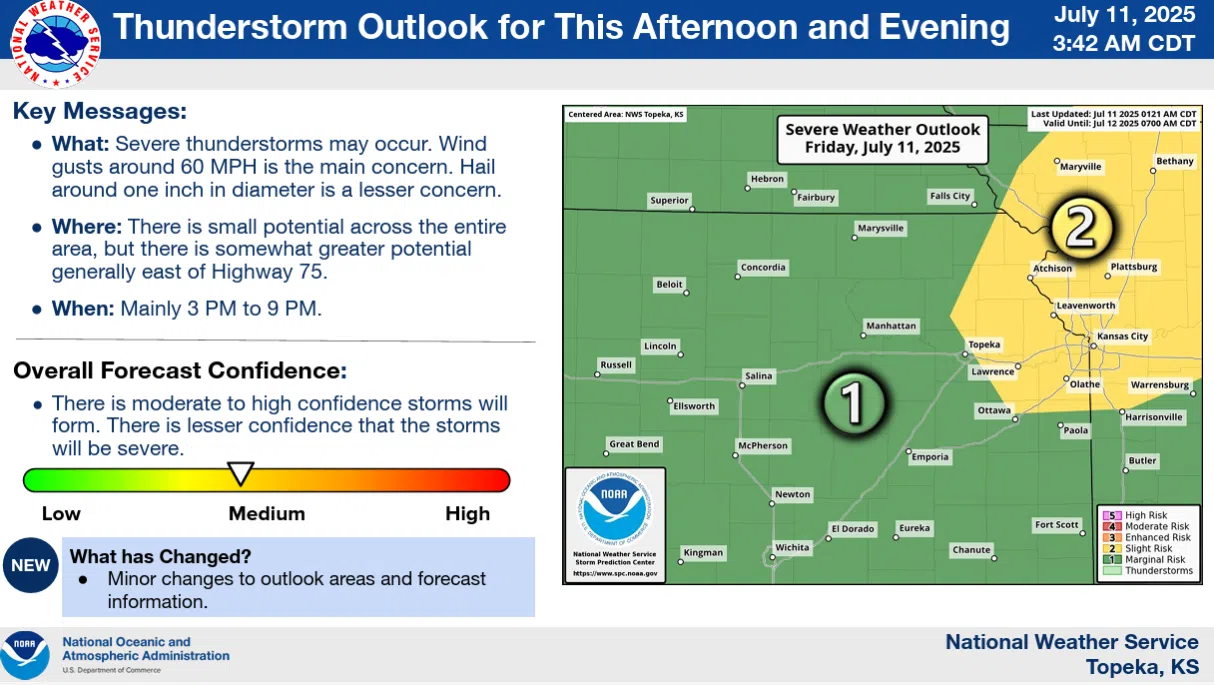
The Storm Prediction Center has all area counties under a marginal risk for 60 mph wind and, on an even more isolated basis, quarter-sized hail. The National Weather Service Topeka office says storms could be crossing the area from mid-afternoon to mid-evening.
Thunderstorm chances will continue at a slight level through the upcoming weekend and overall through most of next week.
Air temperatures will be in the mid-90s Friday, with peak heat index readings at or slightly above 100. Air temperatures for the weekend will be in the mid-80s.
Separately, it may be hard to fathom, given all the rain that fell across the KVOE listening area in June, but most of Osage County is now listed as abnormally dry in the latest update from the US Drought Monitor. Many area residents got 6-10 inches of rain or more as part of storm activity last month, and the Drought Monitor had shown the area as completely drought-free for most of June.
Get updates on KVOE, KVOE.com and KVOE social media.


