


After a Sunday that saw thunderstorms, cold rain and isolated wintry precipitation, it does not appear that anything wintry will be in the area for the rest of the week.
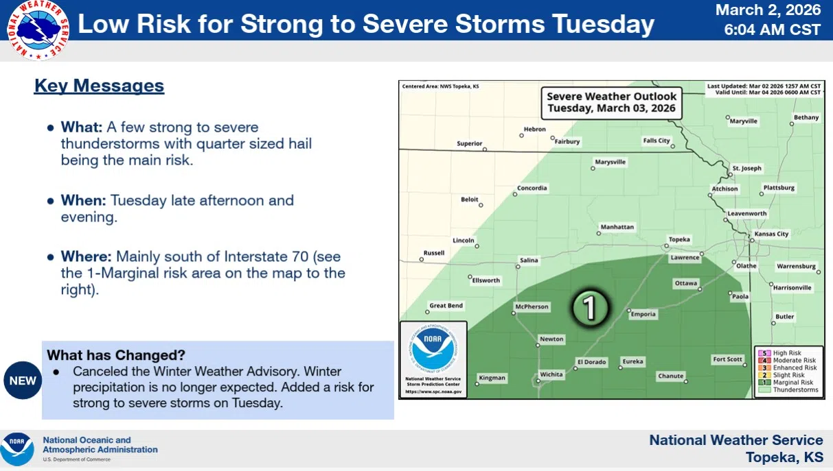
In fact, Severe Weather Awareness Week got an unofficial start with a severe thunderstorm warning for much of Chase County on Sunday — and there is a marginal risk for severe weather late Tuesday night. The Storm Prediction Center says all area counties could see storms generate hail up to quarter size, or 1 inch in diameter. The SPC is targeting midnight to sunrise Wednesday.
The SPC is also looking for at least a slight risk of severe weather Friday across the eastern half of Kansas, as well as parts of Iowa, Missouri, Nebraska, Oklahoma and Texas. Forecast models will give a better sense of the risks as we get closer to Friday, but the current indications are all hazards may be possible Friday afternoon into early Saturday.
Residents may have had isolated wintry precipitation or a severe thunderstorm warning to contend with, depending on the county, but almost the entire KVOE listening area had moderate rainfall:
*KVOE studios: 1 inch
*Emporia Municipal Airport: 0.71 inches
*Country Club Heights: 1 inch
*Deerbrook Addition: 0.70 inches
*South and Sylvan: 0.80 inches
*10th and Weaver: 0.85 inches
*1100 block Constitution: 1 inch
*3.5 miles west of Emporia Golf Course: 1.4 inches
*3 miles east of Emporia Municipal Airport: 0.62 inches
Area totals:
*1 mile north of Allen: 1 inch
*Bushong: 1 inch
*Cottonwood Falls: 0.60 inches
*Kansas Highway 99 at Lyon-Greenwood county line: 0.65 inches
*Lebo Heidi Inn: 0.95 inches
*Neosho Rapids: 0.80 inches
Stay with KVOE, KVOE.com and KVOE social media for updates. Click here for KVOE’s initial story from Sunday.
 (1)")


")