



We will have one more hot day before an extended taste of early fall next week.
After high temperatures in the mid-90s and heat index readings near 100 Friday, nearly identical conditions are expected Saturday.
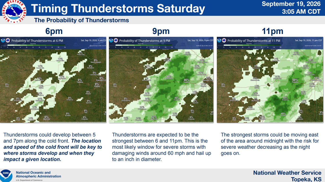
Showers and storms become increasingly likely by late afternoon or early evening, and a slight severe weather risk remains in place areawide. The peak time for severe weather potential appears to be 6-11 pm. Wind gusts up to 65 mph and hail to the size of quarters, or 1 inch in diameter, are the main hazards.
Once the severe weather threat ends, showers and non-severe thunderstorms could continue at times beyond the overnight period and all the way into Sunday night. Temperatures will be sharply cooler, with a high of 81 Sunday, and the cooldown continues with highs in the low 70s Monday and upper 60s Tuesday. Highs should be in the 70s for the rest of next week.
Stay with KVOE and KVOE.com for updates.















